10 Stories That Inspire Us to Choose Kindness, Even When Life Feels Cold

Earth is a living, breathing organism. It is undergoing constant changes — glaciers melt, rivers dry up and appear again, cities expand, forests and deserts shift around. And all the while, our planet remains breathtakingly beautiful. Today, Bright Side brings you a selection of incredible NASA photos that demonstrate how the face of the world has changed over the last century!
What’s most astonishing is how fast these natural and man-made changes occur. The photos below portray transformations with a time span ranging from a few decades to just one year. Some of the photographic evidence is truly unbelievable. Now you have the chance to see these beautiful and thought-provoking images for yourselves!
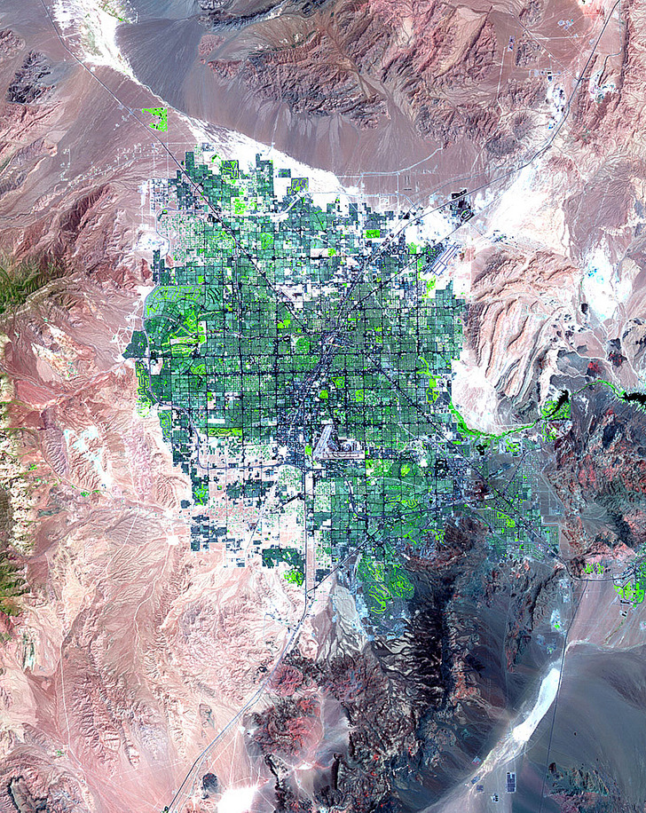
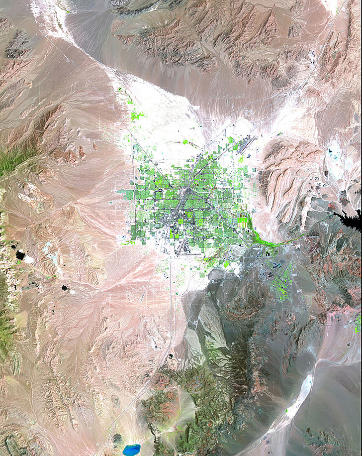
The pictures clearly show both the expansion of the city of Las Vegas and the drying up of Lake Mead on the Nevada-Arizona border. The rapid growth of Las Vegas caused an increase in demand for water. Lake Mead, which holds 90 percent of South Nevada’s drinkable water resources, had to bear the brunt of this demand. Taken in 1984 and 2007, the two photos demonstrate a visible drop in the lake’s water level.
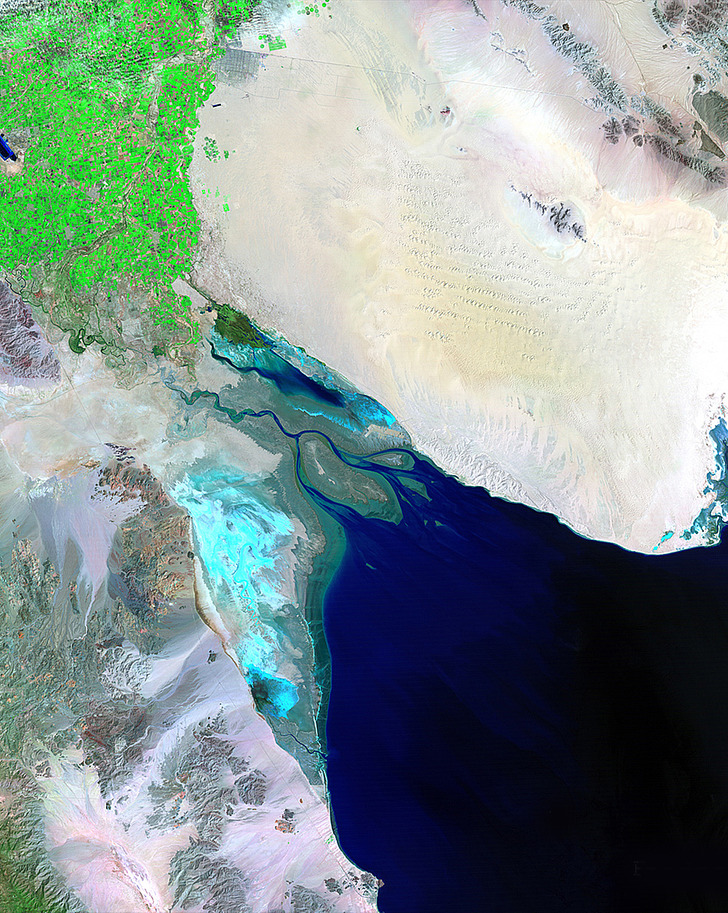
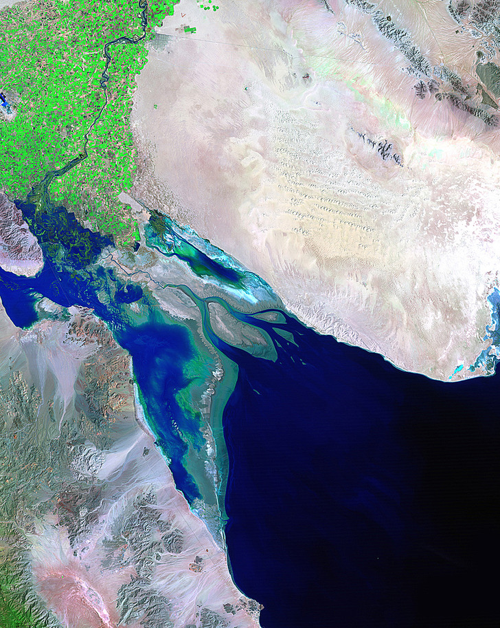
These two photos demonstrate the extremes of water flow in the Colorado River. The 1985 photo was taken at the peak of a record-breaking flood, while the 2007 one shows a period of extreme drought. Heavy rains (or their absence) play a key role in maintaining water levels at the Colorado River basin. The pictures date from March 24, 1985 and April 6, 2007.
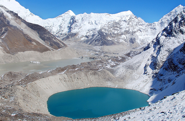
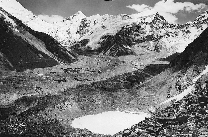
A marked retreat and deterioration of a glacier in the Himalayas. The lake is visibly deeper in the second picture. The first photo was taken in the autumn of 1956, the second one on October 18, 2007.
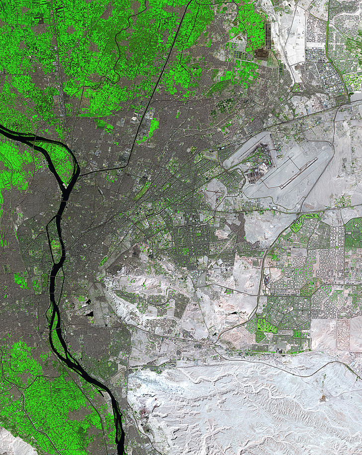
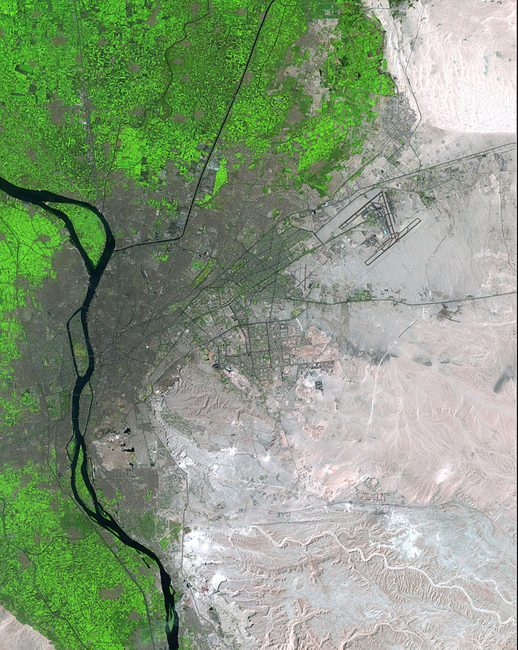
In the time period between the dates on which the two photos were taken, the population of Egypt’s capital had grown from 6 million to more than 15 million. Cairo’s new urban and agricultural districts sprawl out into the desert, nourished by the waters of the River Nile. The two photos were taken on April 6, 1987 and March 15, 2014.
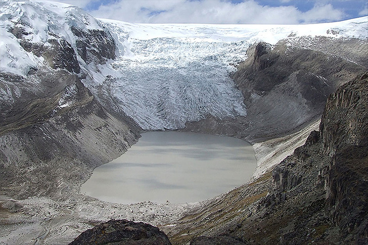
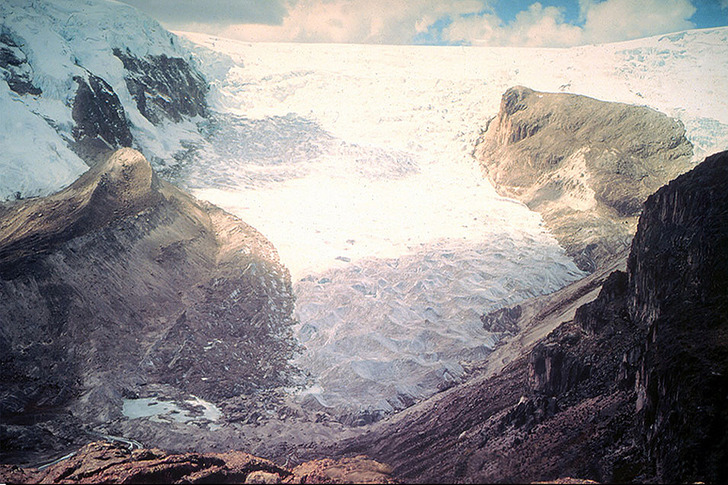
This glacier used to span a plateau situated 5,691 meters (18,670 feet) above sea level, high in the mountains of central Peru. It formed a part of the world’s largest tropical icecap. In 1978, the glacier was still expanding. But by 2011, it had receded dramatically, having left behind a lake about 60 meters (197 feet) deep.
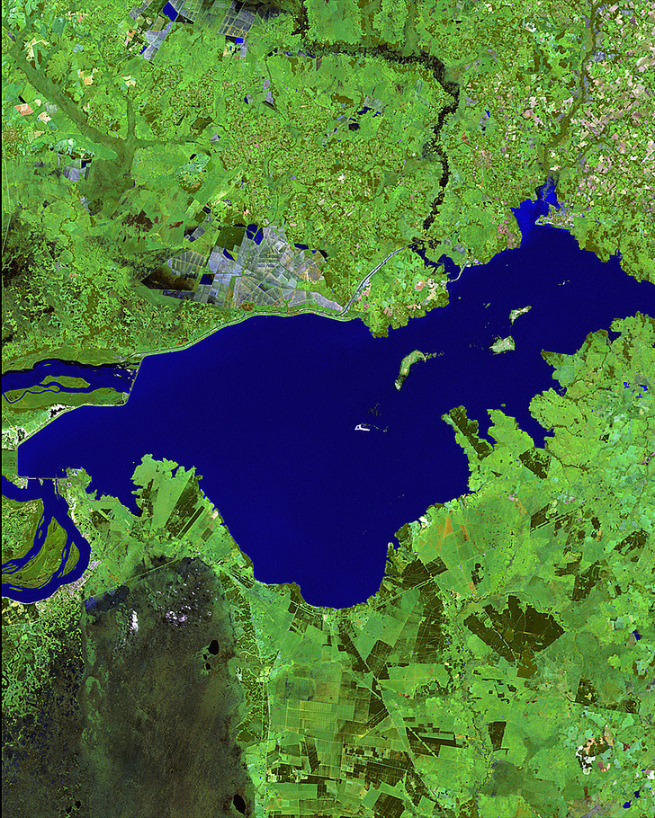
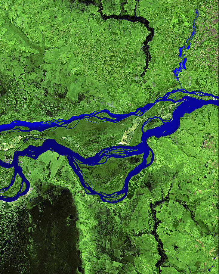
This 1985 picture shows a segment of a river network in Paraguay, shortly after the beginning of the construction of the Yacyretá Dam — a joint Paraguayan-Argentinean hydroelectric project. The construction was completed in 1994. Since then, the rivers’ water level has risen drastically. Large areas of land ended up underwater. Those areas used to be home to jaguars, giant river otters and anteaters — not to mention 650 species of birds and 10,000 species of plants. The first photo was taken May 25, 1985. The second was taken on June 7, 2010.


The Lyell Glacier, the second largest glacier in the Sierra Nevada mountain range, had lost almost 80 percent of its surface area in the time span between 1883 and 2015. Astonishingly, more than 10 percent of the surface area had disappeared in the last four years of that period. Warm and increasingly dry weather is to blame.
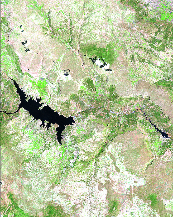
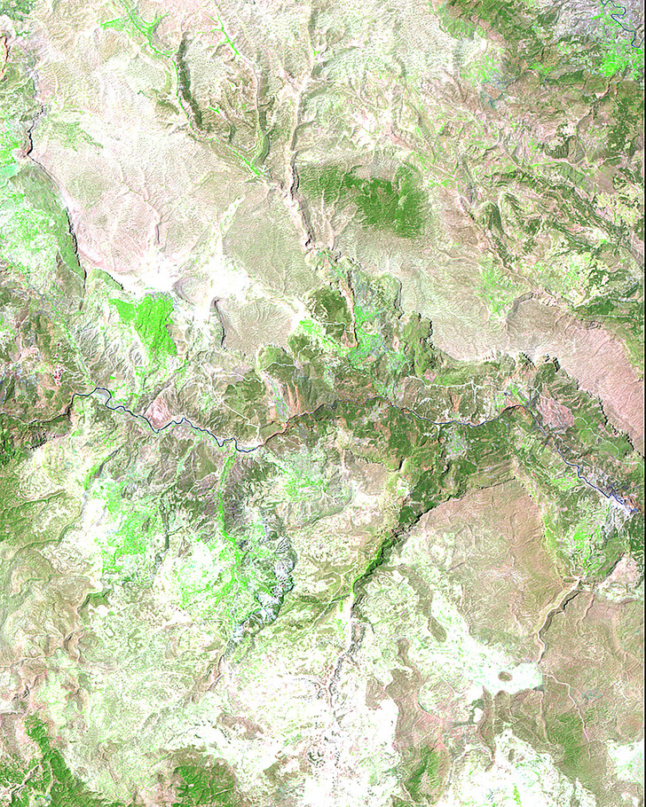
This depicts the Goksu River basin in Southeast Turkey. In 1990, it became the site of the seven dams construction project, intended to solve the region’s power supply problems for decades to come. The project was completed in the early 1990s. As a result, water flow decreased downstream of the dams. Then, in the early 2000s, another dam was built, resulting in the creation of a large reservoir that damaged the delicate local ecosystem and caused many animal species to lose their natural habitats. The photos were taken on July 11, 1987 and July 13, 2011.
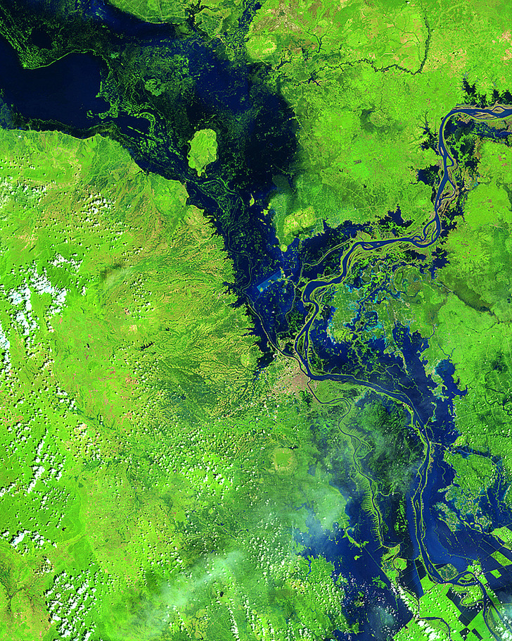
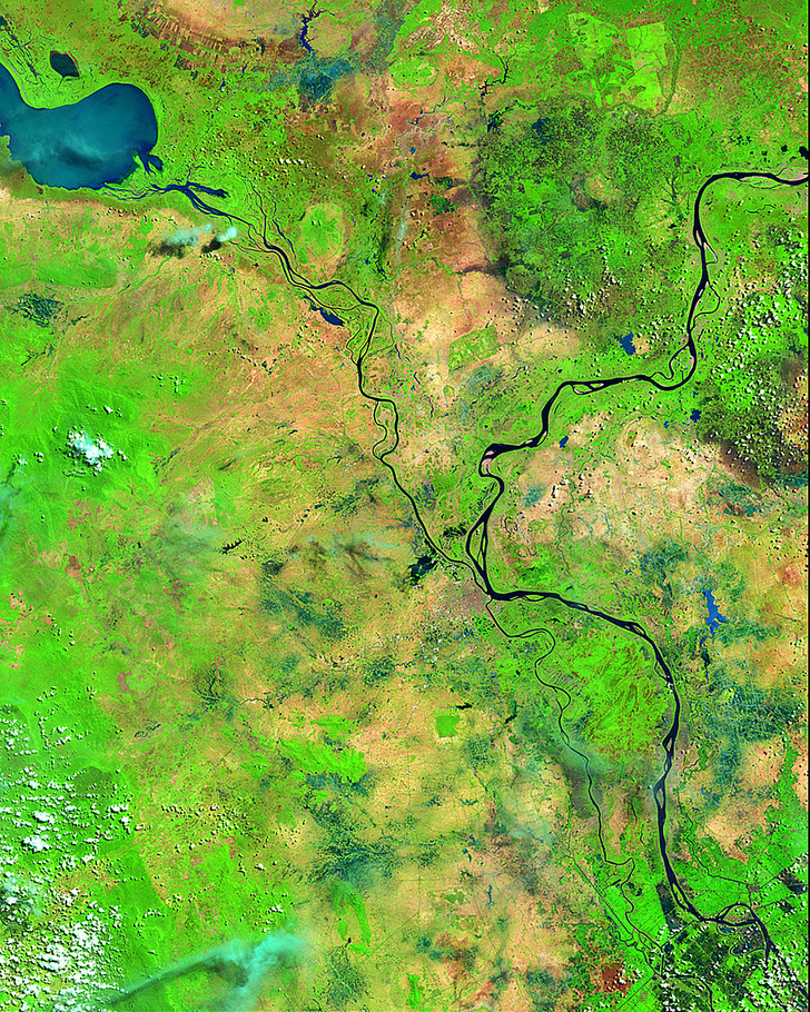
In October 2013, Typhoon Nari, compounded by heavy seasonal rains, caused extensive flooding along the rivers Mekong and Tonle Sap in Cambodia. As a result, more than 1.5 million people were affected and more than 300,000 hectares (74,1316 acres) of rice fields were destroyed. The Cambodian capital, Phnom Penh, is located south of the center of the image. The photos were taken May 17, 2013 and October 24, 2013.
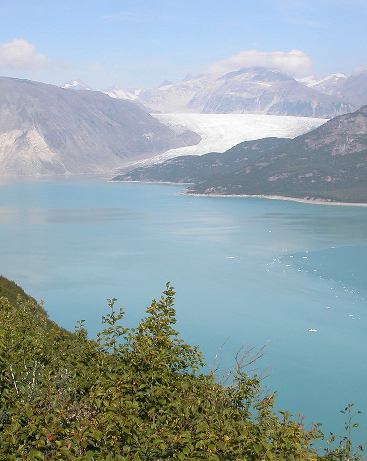
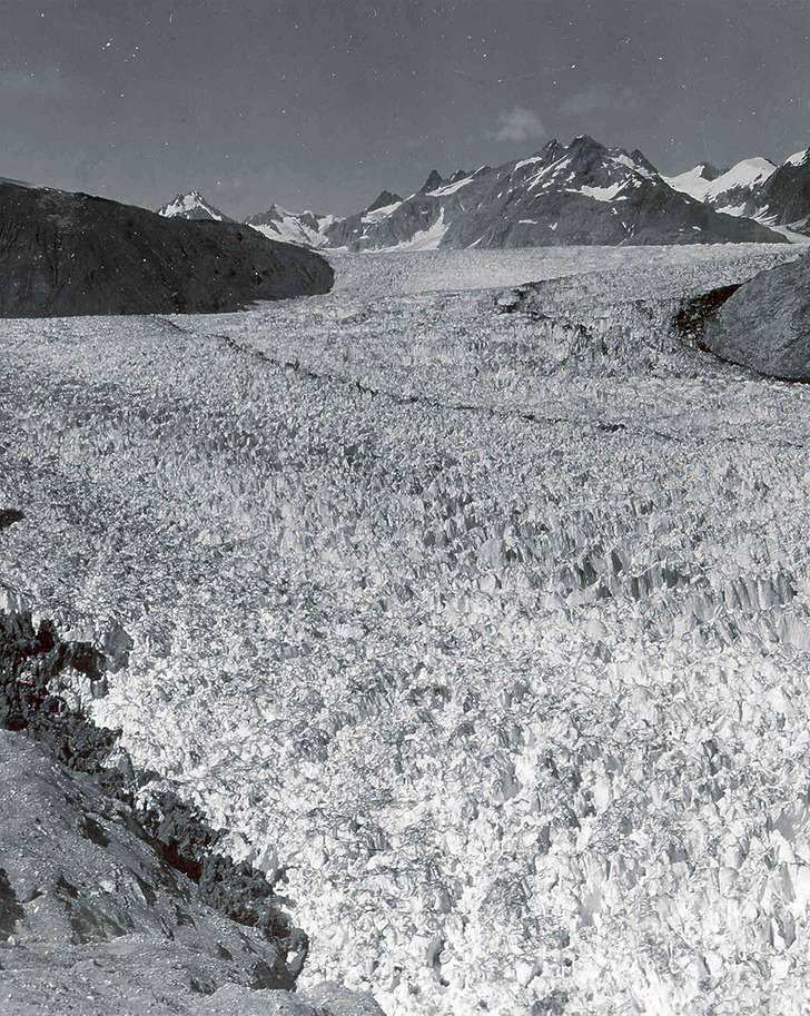
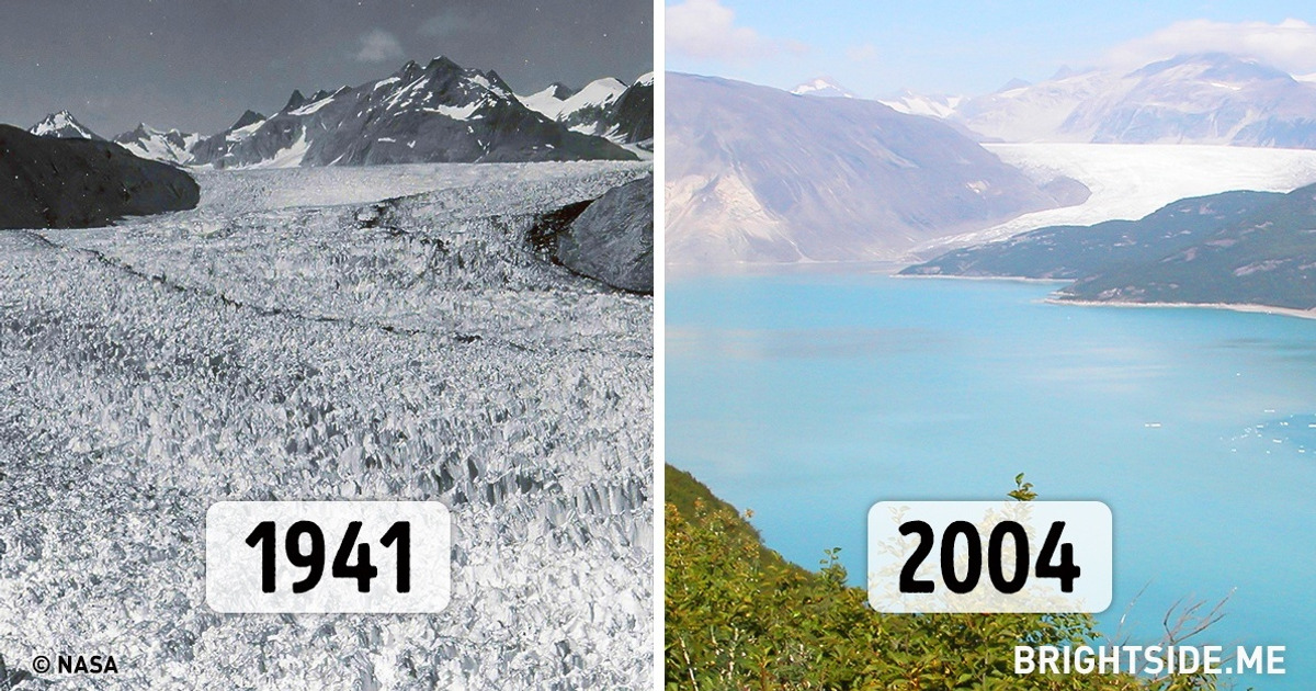
These images demonstrate how Alaskan glaciers have diminished over a period of approximately half a century. The first picture was taken on August 13, 1941. The second was taken on August 31, 2004.
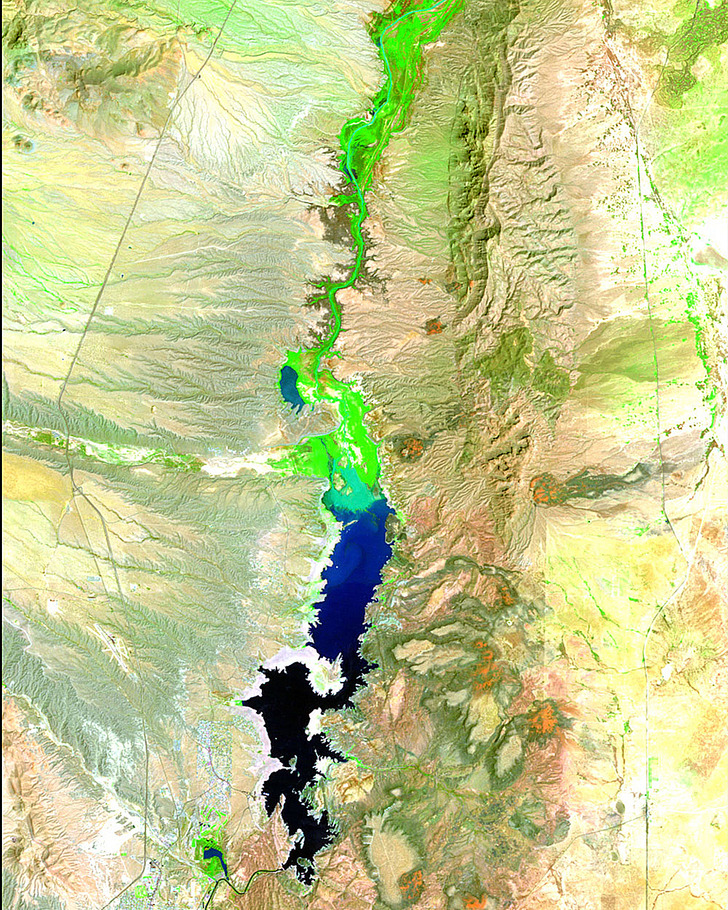
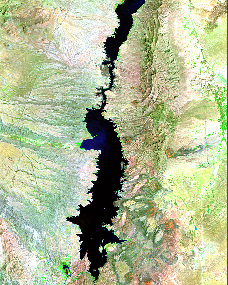
The Elephant Butte Reservoir has appeared as the result of the creation of a dam on the Rio Grande River in 1916. To this day, the reservoir remains the biggest body of water in New Mexico. But over the last two decades, prolonged periods of drought have caused a drastic decrease in its water level. The photos were taken on August 20, 1991 and August 27, 2011.
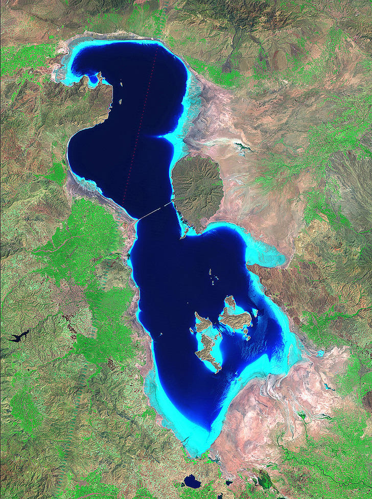
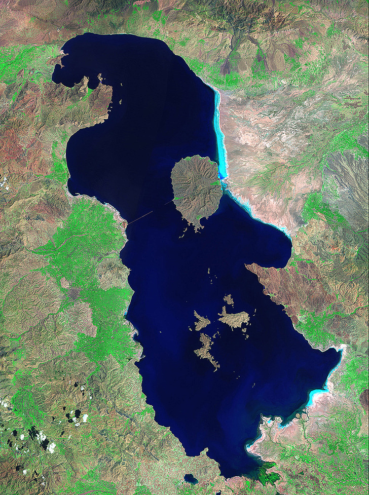
Lake Urmia is considered to be the biggest salt lake in the Middle East and the third biggest in the world. However, multiple factors, including the building of dams, increasing usage of ground waters and prolonged droughts, have caused it to shrink to 60 percent of the size it used to be in the 1980s. The light blue colored areas in the 2010 photo are shallow waters and salt deposits. The increased salination has led to the disappearance of fish. The lake is no longer a refuge for migrating water fowl. If Urmia continues to decline at the present rate, it will soon dry up completely. The photos were taken in August 1985 and 2010.
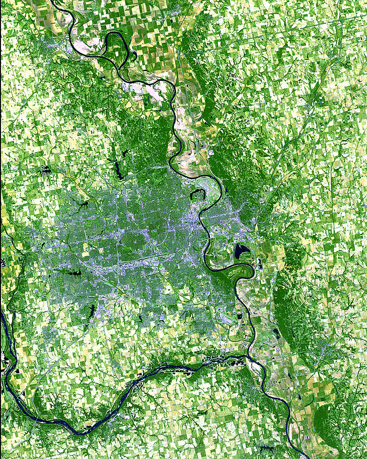
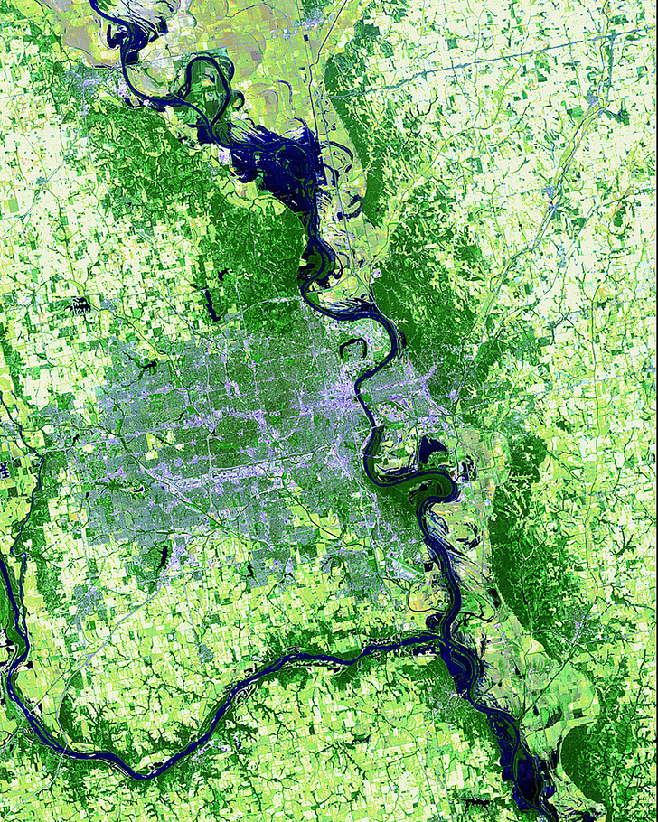
In the spring and summer of 2011, the Missouri River overflowed its banks. Heavy snowfalls in the Montana and Wyoming parts of the Rocky Mountains and nearly record-breaking spring precipitation in Central and Eastern Montana caused the waters to reach a dangerous level. The subsequent warm and dry weather made the floods recede. The images were taken on June 6, 2011 and June 8, 2012.
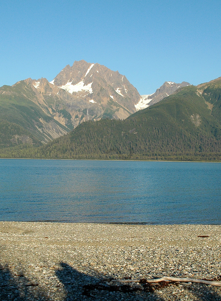
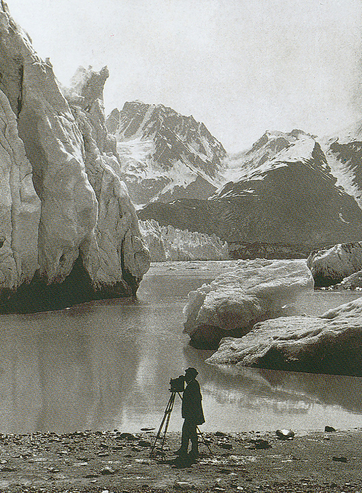
These photos plainly show the dramatic decrease in the surface area of Alaskan glaciers. In the period of one century, the landscape has changed beyond recognition. The pictures show the same area in 1891 and 2005.
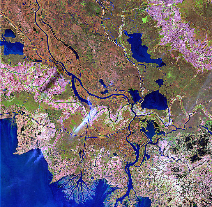
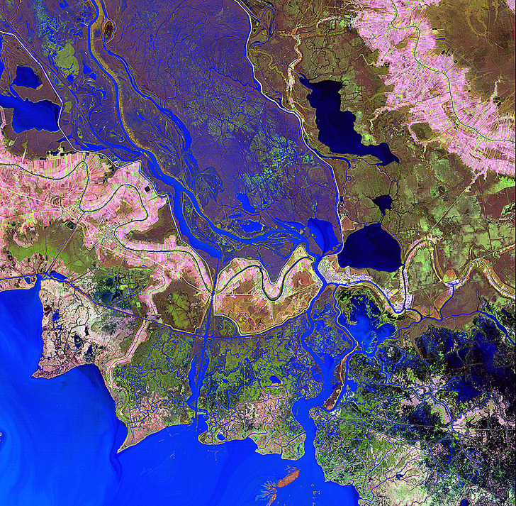
This is Wax Lake Delta, Louisiana. A place where the Mississippi River flows into the Gulf of Mexico, the Wax Lake Delta was formed by rapid deposition of sediment after the completion of a channel through the lake off of the Atchafalaya River in 1941. The delta underwent significant changes as a result of Hurricane Katrina in 2005. The photos were taken on January 13, 1983 and January 2, 2011.


