The commentary about the Diomede Islands is incorrect. If it's Saturday at 6am on one, it's not Sunday at 9am on the other. That would be 27 hours difference. I assume that you meant that if it's Saturday at 9am on one, then it's Sunday at 6am on the other. It's impossible for it to be the other way.
15 Unexpected Geography Facts They Didn’t Teach Us in School
Did you know that you can find yourself in 4 different places at once or play football on different hemispheres of the Earth? Did you know that there’s a point on our planet where people would have a really hard time finding you? Read this article to find the answers to these and many other questions.
Bright Side has found some geography facts that will impress even the most avid readers.
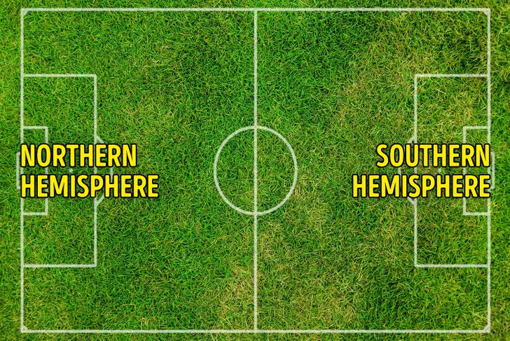
15. Football teams can play against each other in different hemispheres.
The stadium Estadio Milton Correa in Brazil is also known as Zerao ( meaning “Big Zero” in Portuguese.) The thing is, the stadium is located right on the Equator, so that both teams who are playing defend 2 different hemispheres.
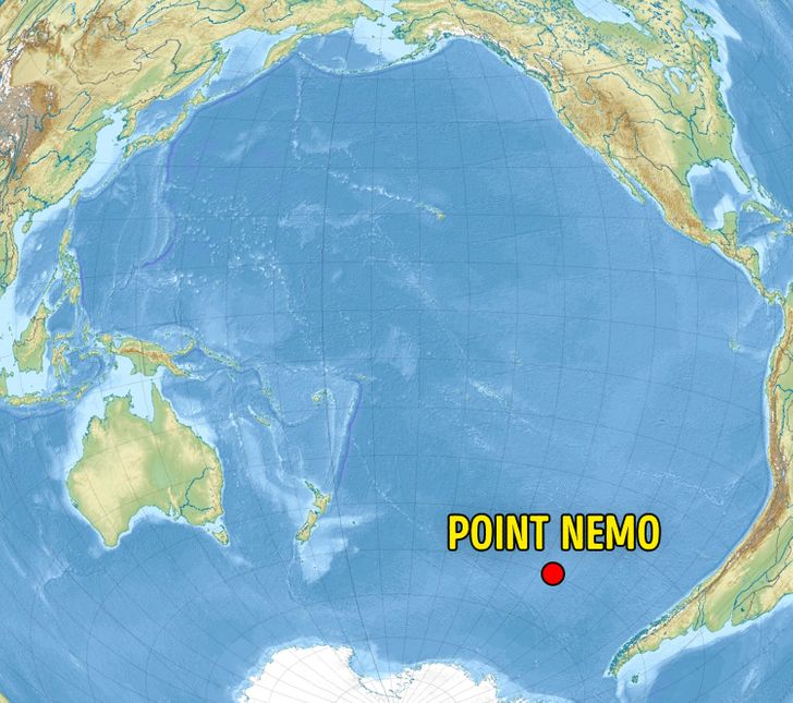
14. Point Nemo is the most challenging point to reach in the world.
In the Pacific Ocean, there’s a point that is the most remote from any piece of land. The closest land is located 1,670 mi away. This place is also known as the pole of inaccessibility. The nearest lands are Ducie Island, Motu Nui Island, and Maher Island.
The point was named after the famous submarine sailor from Jules Verne’s Captain Nemo (20,000 Leagues Under the Sea.)
It’s so far from land, the nearest humans are often astronauts: the International Space Station orbits the Earth at a maximum of 258 miles away.
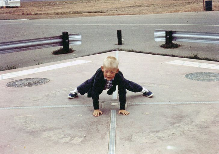
13. You can be in 4 states at once.
Four Corners is a region where Arizona, Utah, Colorado, and New Mexico meet. Thus, you can be in 4 states at once.
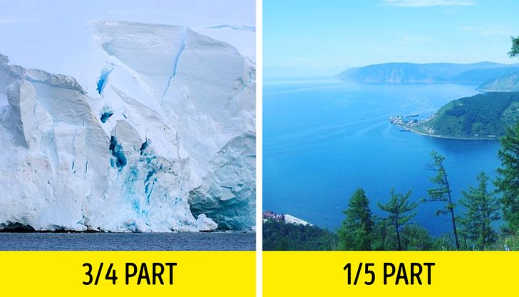
12. Glaciers store most of the fresh water on Earth.
Around 10% of land area on Earth is covered with ice. Glacierized areas cover over 5.8 million square miles. These 10% store about 75% of the world’s fresh water.
If we consider only unfrozen fresh water, it appears that lake Baikal located in Russia contains 20% of the world’s fresh water.
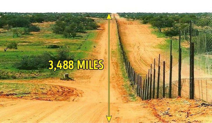
11. The Dingo Fence in Australia is longer than the Chinese—Russian border.
In the 19th century, sheep farming was an essential sector of the economy in Australia. In the 1880s, farms decided to build a fence that could protect the sheep flocks from dingoes. This fence is 3,488 mi long. By the way, the Chinese—Russian border is 2,615.5 mi long.
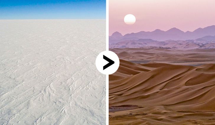
10. The world’s largest desert is located in Antarctica.
A desert isn’t always about hot weather and sand. In fact, a desert is a dry region, where there is almost no water, rain, snow, trees, or plants. Thus, cold regions can also be considered deserts.
So the Antarctic desert is the largest desert in the world: its area is 5,400,000 sq mi.
The Sahara is the largest hot desert and the 3rd largest desert among all the deserts on Earth.
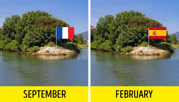
9. Pheasant Island switches countries every 6 months.
Pheasant Island is located in the river Bidassoa and is owned by Spain and France. For 6 months of the year it’s under Spanish rule — and for the following 6 months it’s under French rule.
The island is uninhabited and closed to the public.
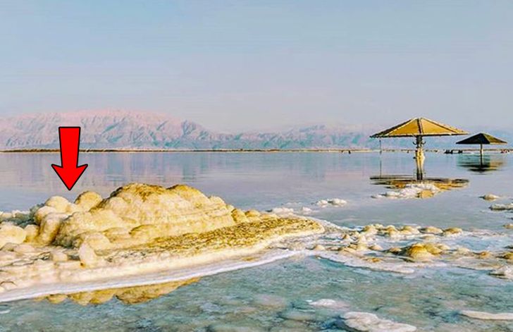
8. The Dead Sea is below sea level.
Levels of salt water are dropping by 39 inches (one meter) every year. Today, it’s 1,412 ft below sea level.
7. In Canada, there’s an island in a lake on an island in a lake on an island.
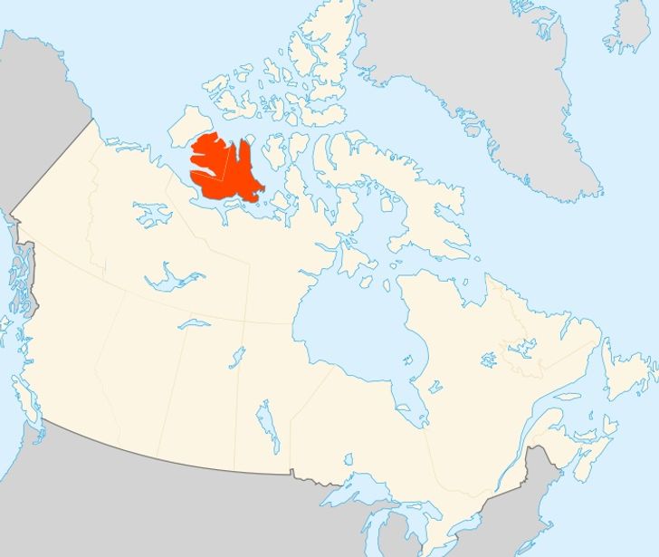
Victoria Island on the map of Canada.
Victoria Island is a large island in the Canadian Arctic Archipelago. It’s an island within an island within an island. By the way, it’s probably never had a human visitor.
6. Caves Er Wang Dong and Hang Son Doong are so big that they have their own climates.
Er Wang Dong is located in China. The current length of its passages is 138,251 ft. It’s so huge that it has its own climate and plants. Locals usually predict the weather by watching the cave. So, if it’s foggy inside, it’ll be rainy outside.
Hang Son Doong is located in Vietnam. Its depth is around 500 ft. There’s a river inside that floods some areas during rains. There are also plants and trees inside.
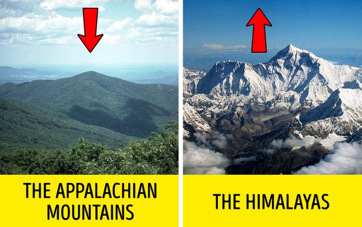
5. The Appalachian Mountains are getting shorter and the Himalayas are getting taller.
The Appalachian Mountains are a system of mountains in eastern North America. Their elevation is 6,684 ft. They aren’t that tall in comparison to the Rocky Mountains (14,440 ft) and the Himalayas (29,029 ft.) But there’s was a time when the Appalachians were taller than the Himalayas. The thing is, the Himalayas are younger and they’re still increasing because the movement of India continues to put enormous pressure on the Asian continent. The Appalachians were formed the same way but there’s no force pushing them up today.
4. In Mauritius, there’s an area of sand dunes that has sand in 7 distinct colors.
You’ll have a chance to enjoy 7 different colors of sand: red, brown, purple, green, blue, violet, and yellow. These sands spontaneously settle in different layers. If you grab a handful and mix it in your hands, the sands will separate by their colors.
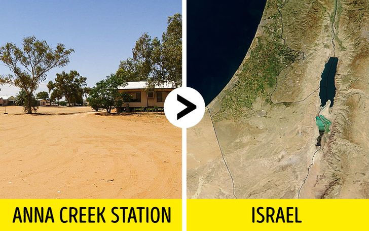
3. Australia’s Anna Creek Station is larger than Israel’s territory.
Anna Creek Station is the world’s largest working cattle station. It has an area of 9,142 sq mi while Israel has an area of 8,019–8,522 sq mi.
The station was established in 1863.
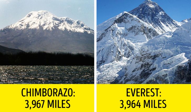
2. Everest isn’t the highest peak in the world.
In fact, the Chimborazo volcano is a bit taller than Everest if we measure the height of the mountain from the center of Earth (Chimborazo is 3,967 mi against Everest’s 3,964 mi). If we measure the height above sea level, Everest is 29,029 ft high. So, if we compare Everest’s height from the center of Earth with other peaks, it wouldn’t even be in the list of the 20 highest points in the world.
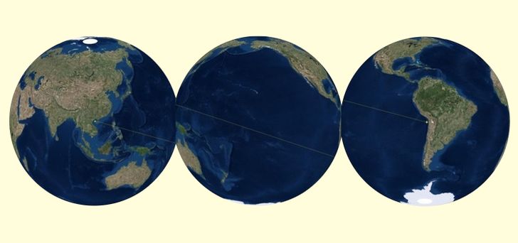
1. The Pacific Ocean is so huge that it contains its own antipode.
The antipode of any spot on Earth is the point on the Earth’s surface diametrically opposite to it. Have you ever wondered which part of the other side of the earth is directly below you? If you have, you’ve thought about an antipode.
The Pacific Ocean is so big that if you dove and swam through the center of Earth, you’d still find yourself in the Pacific Ocean.
Bonus: Thrilling human-made holes
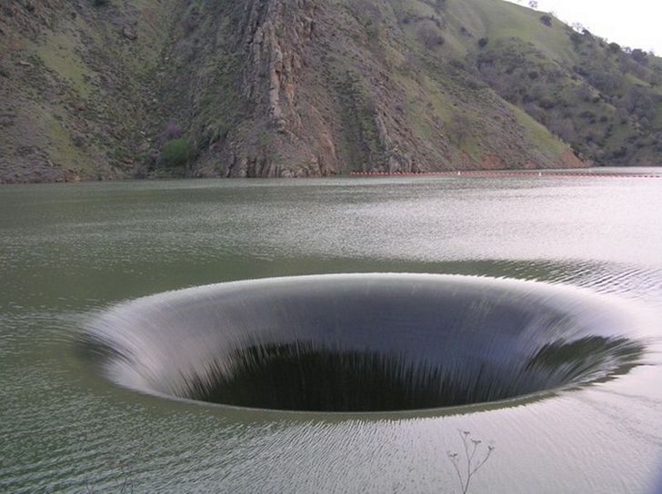
Here’s the Monticello Dam drain hole located in Lake Berryessa, in Napa County, California. Locally, the spillway is also known as The Glory Hole. It was constructed between 1953 and 1957. The hole diameter is 72 ft wide. These constructions are used for dams to drain excess water during dry seasons.
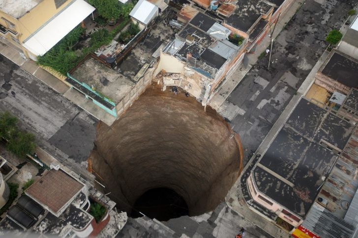
Scientists assume that this Guatemala Sinkhole was probably created by humans, not nature. Sam Bonis, a geologist, says that a burst sewer pipe or storm drain probably hollowed out the underground cavity that allowed the chasm to form. The sinkhole is estimated to be 60 ft wide and 300 ft deep. He also admits that the disaster was probably triggered by the deluge from tropical storm Agatha.
Which fact surprised you the most?
Comments
Related Reads
People Online Noticed Brad Pitt’s New Partner Is a Spitting Image of Angelina Jolie

Helen Hunt, 60, Stuns During Her Latest Appearance, and Her Lips Become the Center of Attention

Keanu Reeves Finally Cuts His Long Hair, and His New Look Causes a Stir

Anne Hathaway Deemed Unrecognizable After Her Face Shocked Many in New Pics

The Most Daring Oscar Party 2024 Looks That Made Our Jaws Drop

I Took the Money My Boyfriend Saved Up for an Apartment and Changed Our Relationship Forever

Miley Cyrus Raises Eyebrows as She Wears a Naked Dress Made Only of Safety Pins at the 2024 Grammys

Meg Ryan, 62, Is Praised for Finally Looking Her Age As She Stuns in Her Latest Appearance

Meghan Markle Subtly Transformed Her Look, but Many Have Missed the Detail She Changed

Kim Kardashian Is Trolled for Editing Her Recent Pic, and It’s Taking the Internet by Storm

The Dreamiest Couples at the 2024 Oscars

12 Situations Moms and Dads React to in Completely Different Ways

