16 Moments That Remind Us to Stay Kind Even If the World Turns Ice Cold

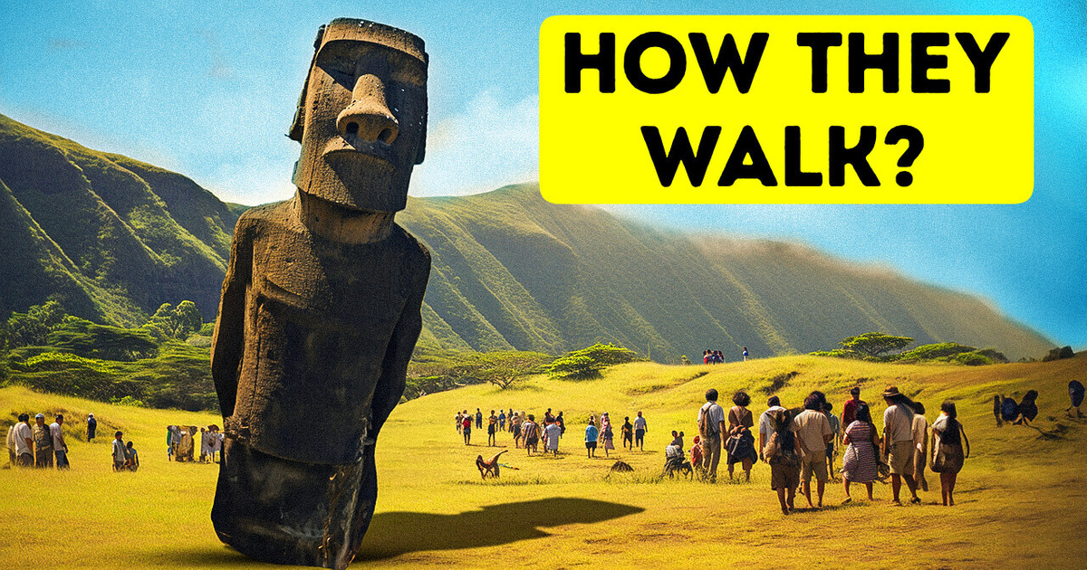
The Easter Island giant heads are so popular that they even have their own emoji. Their true meaning has been a mystery for hundreds of years, but it looks like we at least know how they were built and transported to their permanent location.
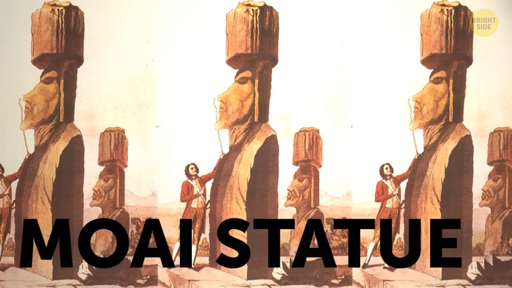
The Moai statues consist of three parts: a large yellow body, a red hat or topknot, and white inset eyes with a coral iris. Around one thousand of them were created. The main bodies of most of the statues were made out of volcanic tuff from a local quarry in what used to be a volcano. The material is easy to carve but not so easy to transport. That’s probably why researchers found over 300 unfinished moai back in the quarry. The rest of them stand in various locations facing the villages as if watching over the locals.
So, it looks like the statues were carved lying on their backs. Then, their creators detached them from the rock, moved them down-slope, and set them in a vertical position to finish the work. Once it was done, it was time to get the statue to its platform. Now, if you’ve ever moved houses, you know how physically hard it is. So, imagine having to move a statue that is about half as heavy as a house without a car or any modern equipment for a distance of 3 miles. The locals must have invented some original way of doing it, and scientists tried to recreate it to guess what it was. They tried pulling moai replicas on wooden sleds. They thought someone could have used palm trees for that purpose, but this theory has been debunked. The most successful experiment so far was wielding ropes to rock the statue down the road in a standing position. This method sounds real because the local Rapa Noi legends mention that the Moai walked from the quarry.
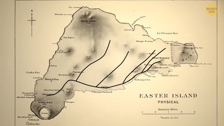
And, of course, they needed a good road to get there. In the early 20th century, researcher Katherine Routledge identified an 800-year-old road network on the island. It was a bunch of pathways around 15 feet wide going from the quarry. She thought that those roads were ceremonial and not built just for the statues. She wasn’t a famous scientist back then, so others mostly ignored the theory. Several decades later, famous Norwegian adventurer and archaeologist Thor Heyerdahl published his theory. He mentioned that the roads were built exclusively to transport the Moai, and some of the statues were dropped along the roads for some reason. But in 2010, researchers found that the statues weren’t randomly dropped. They actually reached their final destinations as they were all set on hidden platforms.
Plus, the road floor was U-shaped, so pulling massive statues along them wouldn’t be easy. You can still find roughly 15.5 miles of these roads on the island and see them from satellite images. And it looks like Katherine Routledge was right about them: the roads were probably built for pilgrims to a sacred volcano, and the Moai standing by them were sort of signposts.
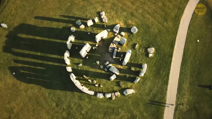
Halfway across the world, in southern England, lies another mystery made of stone. A massive sound illusion, a symbol of unity, a burial ground, or more — scientists are still debating the purpose of Stonehenge. It took Neolithic builders around 1,500 years to construct this beauty, made of roughly 100 stones standing upright in a circle. Millions of tourists come to see it every year, and heritage protectors were worried about the modern road snaking close to the landmark.
That modern road is now sunk into the ground below the grass level. And even though archaeologists assumed they could find an older road under it, they didn’t have any high hopes. But when they took off a layer of asphalt, they noticed two parallel ditches that were nearly perpendicular to the road. The ditches connected the shortened sections of the avenue — that’s what the archaeologists call the ancient pathway leading up to Stonehenge. It proves that the ancient people used to visit the monument for their purposes and probably some ceremonies.
Another interesting find during a dry summer was three dry patch marks within the stone circle. It looks like they were left by three massive boulders. So, Stonehenge could have been a full circle once. In 2021, archaeologists found a Roman road submerged in the Venetian Lagoon. The fact that it runs there, on the bottom, for nearly 4,000 feet is proof that the Romans were here before sea levels rose and flooded the area. It supports the theory that there was an important settlement here centuries before Venice was founded at the spot in the fifth century CE. The ancient Romans were great at many things, and one of them was building roads. And it looks like they weren’t afraid to work on the trickiest terrain. Scans have shown that the ancient road was built right on the beach, and it requires some serious skills.
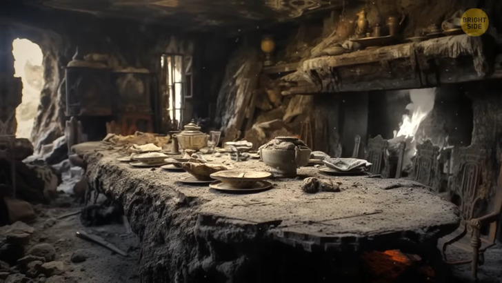
Imagine a village from over a thousand years ago frozen in time. There’s still half-eaten food on the tables and personal things left in a rush. It is all preserved so well because it’s covered by volcanic ash. Researchers found this village in 2011 in modern-day El Salvador. They believe there was a mass celebration in a Maya village called Ceren over 1,400 years ago. The whole village was there, preparing the main temple for a ritual when a nearby volcano erupted. The 200-plus residents had no time to rush back to their homes. To save their lives, they had to flee the plaza and run south on a raised road called sacbe. They managed to escape from the plumes of volcanic ash. In addition to being a superhero and saving all the people, the road had another cool feature. All sacbe roads had an outer layer of stones, but this one was made of ash. Ironic, isn’t it? It proves that the Maya people didn’t only use stones to build their roads.
Archaeologists discovered several coins in Jerusalem when they were excavating an old street. When they saw the minting dates, they realized the road was built when Pontius Pilate was the Roman governor of Judea. Since he was the local ruler, it is almost clear that he gave the order to build the road. The pilgrims most likely used this road to reach the Temple Mount for worship. The pathway, which was laid with over 10,000 tons of limestone, was almost as broad as a London bus is long. It had been there for two thousand years. It’s not common that you find such a luxurious road, and it’s not clear why a Roman governor would spend so much money on the road. It was probably his attempt to make the city’s population like him. Plus, it was a great way to show he had both money and influence.
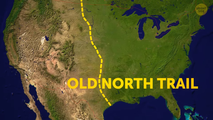
The Old North Trail is an ancient highway that the inhabitants of North America used for 10,000 years, first on foot, then with dogs, and finally with horses. The first travelers moved around the continent down its paths for thousands of miles long before the first Europeans arrived, and even during the last ice age. They used it to carry trade goods, visit relatives, find a mate, or just explore. Researchers keep finding evidence that the stories and legends of the Blackfoot Indians about this Trail are real. And it could even be the road that served one of the most massive human migrations! The people who crossed from Asia on the Bering Land Bridge about 15,000 years ago and settled in North America might have used the ice-free corridor along the Rockies, which later became a part of the Trail.
The Nakasendo Highway was built in the 17th century, during the Edo Period of Japanese history, to link Kyoto and Tokyo. The 310-mile-long road runs across mountain ranges and down onto the plain. It was one of the five main roads used by the feudal lords and their families to travel to the capital. There were 69 post stations on the route where travelers could stay overnight. The road was built for horses and pedestrians, as the Japanese didn’t use carts. You can still walk parts of the route.


