18 Stories That Prove Kindness Can Come From the Most Unexpected Places

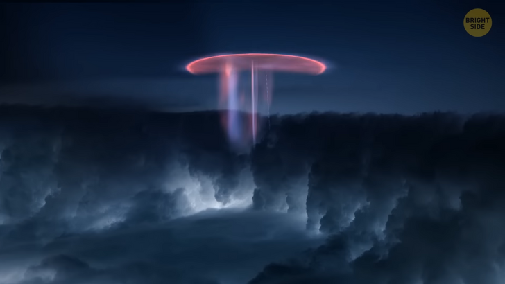
You’re dozing off in your window seat on a plane — it’s getting dark since it’s almost 11 PM. Suddenly, something wakes you up. You glance out of the window and see a really strange phenomenon. Something that creeps you out... There are bright red huge flashes illuminating the sky at a distance. They resemble some nightmarish jellyfish. Those are sprites — also called red sprites due to their color. They’re also known as cloud-to-space lightning. These varied visual shapes flickering in the night sky are large-scale electric discharges (which is a clever word for a lightning strike).

They occur high above thunderstorm clouds — at altitudes of 30 to 56 miles — that’s why you can see them so well from your plane window. The coolest thing about sprites is that they’re positively charged lightning. This is a very rare type that makes up a mere 5% of all lightning strikes! People first spotted this phenomenon in 1886, and it was first photographed in 1989.
In 2018, the legendary Niagara Falls, located at the border between New York State and Ontario, Canada, managed to surprise everyone. Tourists who came to admire the roaring waters found the falls frozen! Well, the waterfalls weren’t frozen per se — this is impossible for a mass of flowing water that huge. But microscopic water droplets, as well as the mist, formed a crust of ice over the rushing water. It created an illusion that Niagara Falls was frozen all over. In reality, the water kept flowing beneath the ice. Imagine ponds filled with ice-cold water and covered with ice. Easy, huh? And now picture dozens of alligator snouts that are poking out of the ponds, still and frozen in ice. That’s what you’d have seen if you had visited the swamps of North Carolina at the beginning of 2018.
Despite this terrifying picture, the animals were very much alive! That was a very special crocodile way to survive abnormally cold weather. Since their nostrils were above water, the animals could breathe — meanwhile, their bodies were in a hibernation-like state. It allowed the animals to conserve energy and stay warm.
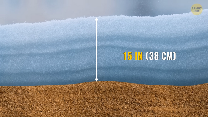
In the winter of 2018, the inhabitants of the Sahara Desert, one of the driest and hottest places on the planet, woke up to discover a thick layer of snow covering the sand. In some places, its depth reached a staggering 15 inches. Meteorologists had an explanation for this exciting phenomenon. They said that cold pools of air, combined with the precipitation from the most recent storm, resulted in snowfall instead of rain. It happened in June 2009. People in some areas in Japan left their homes after a heavy downpour... only to find fish, frogs, and tadpoles everywhere. Fields, roads, lawns, and house roofs were littered with these creatures. One man even found 13 carp on and around his truck. No one knows for sure where this bizarre rain came from. But the most popular theory is that a powerful waterspout picked up the animals. Then it carried them through the upper atmosphere and dropped them on the unsuspecting people below.
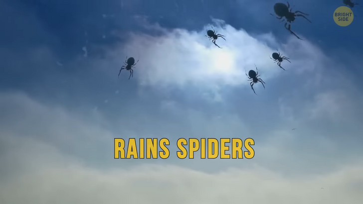
In Australia, it sometimes rains spiders. That’s because these creatures can “balloon”! It’s a highly unusual way of traveling. A spider climbs to the very top of a tall tree or shrub. And then it spins several strands of silk which then help the spider to be carried away by the wind. It’s not easy to spot “ballooning” spiders. But sometimes, when the weather is especially damp and unpleasant, “mass-ballooning” occurs.
Millions of spiders set off on a journey to find another place with better conditions. It may look as if it’s snowing outside. But no — those are spiders drifting down to the ground. The world’s longest lightning storms happen in Venezuela and can last for 9 hours per day! The heart of the storm is over Lake Maracaibo, and the clouds tower way higher than your regular thunderstorm clouds. This natural phenomenon (also known as Catatumbo Lightning) occurs during 140 to 160 nights a year and can produce up to 28 lightning strikes per minute!
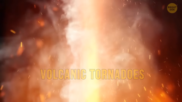
You’ve probably heard how they say that lightning doesn’t strike twice in the same place. Well, Catatumbo Lightning seems not to know about this rule. At least, it doesn’t prevent storm clouds from gathering in the very same place, year after year. Volcanic tornadoes are possibly one of the most terrifying natural phenomena. When a volcano erupts, it spews red-hot rock and ash high into the atmosphere. And solid lava pieces and hot gases travel down the volcano’s slope. When this flow is moving down, some of the trapped gases begin to rise and spin at the same time. They get squeezed by the surrounding air, which makes them spin faster and faster. That’s how a volcanic tornado gets born. Luckily, this phenomenon has a very short lifespan.
Even though the island of Newfoundland in Canada can’t be called the warmest place on Earth, it’s still not that cold. But imagine having to shovel snow in front of your house just several days before your summer vacation! Well, that’s exactly what happened on the island in June 2018. A cold storm that came from the coast of Newfoundland covered several regions of the islands with a 2-inch layer of snow. On top of that, the temperature broke all the records as well. During Newfoundland summer, it’s usually about 66˚F on an average and 90˚F on a very hot day. But that infamous June impressed people with only 37˚F in the morning! Brrr...
Morning glory clouds are extremely rare. They look like massive tubes stretching across the sky. They can snake for more than 600 miles, sitting relatively low. Most researchers agree that these clouds appear when an updraft squeezes through the cloud. This creates the signature rolling appearance. The cool air at the back of the cloud makes it sink downward. The best (but not the only) place to see the morning glory is Australia’s Gulf of Carpentaria. If you decide to travel there to see these clouds, choose a period from late September to early November. On March 19, 2018, the inhabitants of Alabama saw huge chunks of ice falling from the sky. It was the infamous hailstorm of Alabama which caused millions of dollars worth of damage. After the hailstorm, the place looked ruined: broken shop windows, smashed car windshields, broken billboards, and holes in the roofs.
But what made researchers really excited was a hailstone found near the town of Cullman, Alabama. This softball-sized monster was more than 5 inches across, setting a new state record. In 2012, the sky over Dorset, England, turned first ominously dark, then yellow. After that, blue gelatinous balls started to fall to the ground. A local man was walking to his garage when he spotted something unusually bright among whitish hailstones. When researchers examined this “jelly rain,” they found out the balls were made of the substance used in diapers or potting soil. It’s used to absorb liquid. It’s still unclear whether the balls fell from the sky. Or maybe the melting ice made a few already existing crystals expand in the blink of an eye.
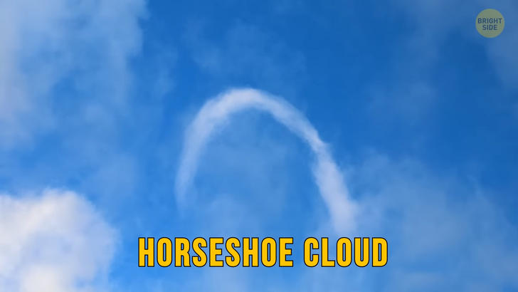
In March 2018, people in Northern Nevada could see the rarest and most bizarre cloud ever — a horseshoe cloud. It sure looks bizarre and kinda scary. But meteorologists know that this interestingly-shaped vortex happens when a flat cloud travels over a column of warm rising air. This air creates the shape and adds some spin to the cloud’s movement. Such clouds are very fleeting and usually last for only several minutes.
Cylindrical snow donuts occur when a wind gust decides to play snowballs. It starts to roll some snow across a snowy area. If it was a real snowball, it would eventually become too heavy for the wind to move. But the center of a snow donut is hollowed out. This happens because its inner layer is too thin and gets blown away when the donut is formed. This makes it lighter than a regular snowball. That’s why it also rolls farther. Unfortunately, you can’t just go and find snow donuts. They are rare because they appear in very precise conditions.


