12 People Who Mastered the Art of Keeping Their True Motives Hidden

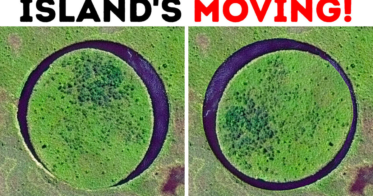
Imagine you’re a movie director looking for beautiful landscapes to shoot a movie. You walk along the picturesque Paraná River and find a perfectly round island in its delta. It’s slightly larger than a soccer field.
You come back a few days later and see that the island has changed its position! It’s moved a little to the side and spun around its axis.
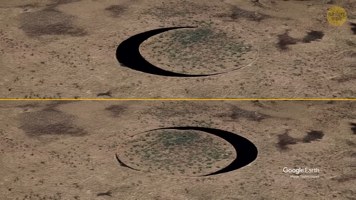
This is what happened to Argentinian director Sergio Neuspiller in 2016. He discovered an island that constantly moves around its axis. He called it “The Eye.” If you look at it from a bird’s-eye view, you’ll see that it’s similar to a slowly moving eye. It’s like nature itself is looking at you.
The director forgot about his initial movie idea and decided to make a documentary about this island. You can find the Eye in the northeastern part of Argentina. Or you can open Google Maps and type “El Ojo” to see it.
No one had known about this place before the director found it. Perhaps, there are many such moving islands on the planet. If you look at satellite images of this area, you can see other similar pieces of land inside lakes. But they’re not so round and don’t rotate. Surprisingly, scientists haven’t yet solved the secret of the bizarre island.
The most popular theory says that underwater wells create strong water flows and change the current that pushes the island from side to side. When the Eye collides with the ground, it bounces off like a ball, causing parts of its muddy shores to break off. But not everyone looks for a scientific explanation for this natural phenomenon. Some locals believe that the island is part of some kind of technology created by space civilizations. Oooh!
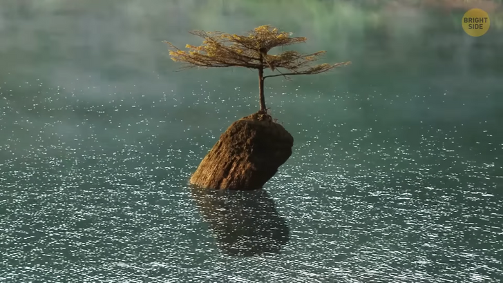
Our next stop is the smallest island in the world. No one can even step on it because of its size. So, here’s Vancouver Island in the Canadian province of British Columbia. Fairy Lake is located here.
Look at the water! You may not notice the island at first. Technically, it’s not even an island. It’s just a piece of a log sticking out of the water. This log is covered with moss and grass. But the most incredible thing is that a tiny Douglas fir grows on this piece of wood.
The photo of this tree has won many awards and become famous worldwide. It shows how desperately nature can strive for survival. Every day, many tourists sail around this island and get inspiration from it.
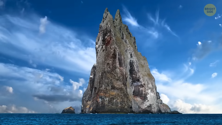
The next island looks ominous and lifeless. It’s the perfect place to build a hut and write horror novels using an old typewriter. The place is called Ball’s Pyramid. It’s located in the waters of Australia, in the Tasman Sea. You can see this colossal fin sticking out of the water from afar. This is a sharp stone ridge with a height of 1,800 feet, almost twice the size of the Eiffel Tower, in the center of an uninhabited volcanic island.
It’s dangerous to approach the place and step ashore because of its slippery stone surface. Scientists come here with special equipment and probably some good boots with traction. The purpose of their visits is a mystery that lies in the heart of the ridge. It was first discovered in 1788. The navigators who found it considered the island lifeless. And so, it was believed for more than 200 years.
But then, in 2001, people decided to examine the place again. A group of scientists arrived there and found one of the rarest insects in the world. At a height of more than 100 feet, a small bush grew. A colony of land lobsters — also called “walking sausages” — was hiding there. These are critters from the family of stick insects. They look pretty creepy since each of them is about 6 inches in size, which is the average size of a sausage.
Isn’t he the “wurst”? Get it? Wurst — sausage. Never mind. The bodies of these 6-paw beetles are covered with a hard brown shell. Scientists found 27 insects, and their population keeps growing. These creatures were considered extinct at the beginning of the 20th century. Scientists still don’t know how these beetles got to this remote, harsh place and how they managed to survive there.
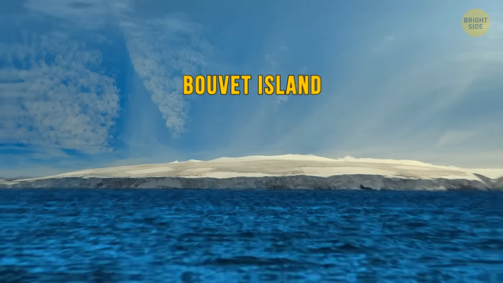
The next unusual place is probably the most isolated and one of the most mysterious in the world. Welcome to Bouvet Island, located in the southern Atlantic Ocean, 1,600 miles from the coast of South Africa and 1,100 miles from Antarctica. It’s possible to get there only if some big ship is passing by. An ordinary motorboat won’t be able to reach this place because of the cold temperature and icebergs.
The island is completely covered with ice and has a volcano crater in its center. You won’t find anyone living there except penguins and seals. One French explorer discovered the island in 1739. But then its coordinates were lost. People found this place again only at the beginning of the 19th century.
But people set foot on the shore of this island for the first time only in 1927. Then, closer to the 50s, they decided to build a weather station on it. Researchers came there and found something strange on the icy surface of the island. And it wasn’t due to the penguins and seals.
It was a lifeboat lying in a small lagoon among the seals. It was in good condition. Not far from the boat, they found oars and an empty copper container. Perhaps some ship went down nearby, and the survivors reached the island in this boat. But the researchers found no traces of people. Until now, this boat remains a big mystery.
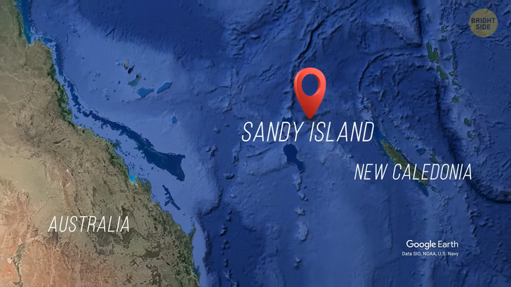
How about visiting an island that doesn’t exist? It’s in the South Pacific Ocean between Australia and New Caledonia. It’s called Sandy Island. It was first discovered in 1876. Researchers began putting it on maps at the beginning of the 20th century. But when people arrived at the specified coordinates, they found no island.
So, by 1970, people had removed it from all the maps released at that time. Then in 2012, Sandy Island appeared again. This time, on Google Maps. The researchers came there but still found nothing. Maybe it had gone underwater? With the help of echolocation devices, they explored the seabed but didn’t notice any signs of an island.
They found out that it appeared on the maps because of human error when printed cards were being transferred to digital ones. The mistake was quickly corrected, but a trace of it remained. If you enter these coordinates into Google Maps, you’ll see a mysterious black spot in the middle of the ocean. And that’s precisely where I am narrating this story... Nah.
But how did people discover it in 1876? Most likely, it was an underwater volcano that woke up and spewed some magma out. In cold water, it solidified and turned into pumice. So, people on that ship must have noticed huge floating pieces of volcanic rock and mistook them for an island.
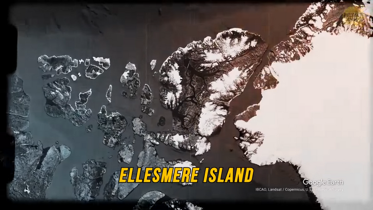
Our next island could be a new continent but turned into nothing. At the beginning of the 20th century, famous marine explorer Robert Peary, the first in history to reach the North Pole, went on an expedition to the northernmost Canadian island — Ellesmere. He was on the shore, looking through his binoculars at the ocean.
In the distance, amid the white snow, he noticed the white peaks of a giant island stretched across the horizon. The traveler didn’t have enough food and fuel to get there and check out this land. He wrote the coordinates in his diary and went back to the mainland. Together with other researchers, they concluded that he had found not just an island but a new continent.
A few years later, Robert Peary organized a new expedition to that place. But this time, he couldn’t find the mysterious icy land. The ship stayed in cold waters for several days, drifting from side to side. The crew was running out of food and fuel. They were about to go back, but then they noticed those snowy peaks again.
The joy of discovery was quickly replaced by disappointment. Those peaks were just fog. Under the influence of cold air and the sun’s rays, the fog looked like an island at a certain angle. When the ship approached it, the island dissolved like a mirage... Oh, well.


