15 Acts of Kindness That Prove Quiet Empathy Is the Only Real Superpower

Have you ever felt so happy that you were up on Cloud Nine! In truth, they don’t actually number these guys, but they’re cool nonetheless, and I can show you super rare phenomena related to clouds.
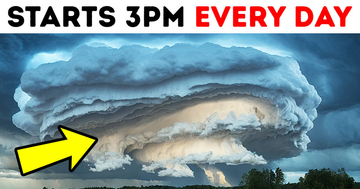
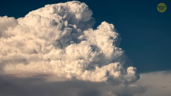
Hey, what time is it? Hmm, I see Hector, so it must be 3 pm. Umm, who is Hector? Oh, Hector isn’t a person. It’s a thundercloud cluster. It forms almost every afternoon from September to March over the Tiwi Islands in northern Australia. Since Hector has this consistent timing, airline pilots and boat captains have used it as a navigational guide for decades.
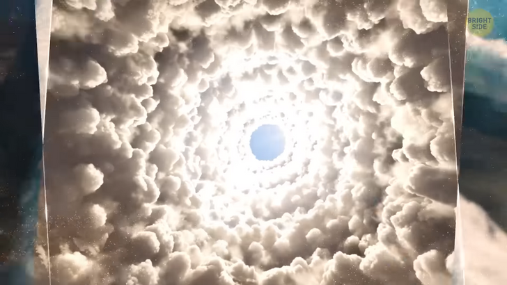
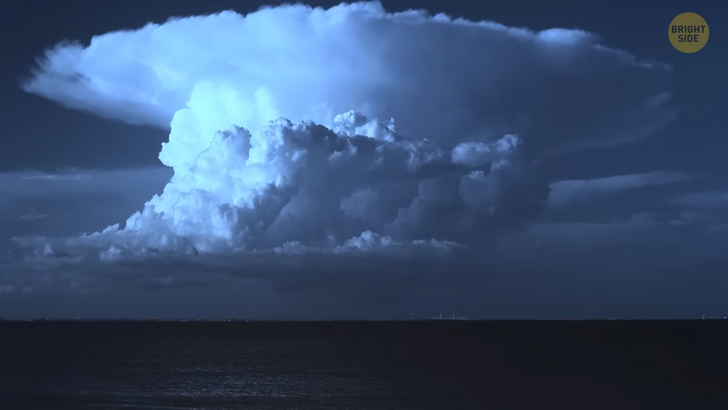
This is a unique thunderstorm not just because it’s very punctual but also because it’s one of the world’s most consistently large thunderstorms. “Hector the Convector,”-yeah, it’s sometimes referred to with an even cooler name-reaches heights of approximately 66,000 feet. What we see is vertical speed billowing white clouds. On top of the clouds, we have an anvil or mushroom shape cloud, like a cherry on top of a cake. By the way, this anvil can go up to thousands of feet high.
So, how is this thundercloud formed, and why does it only pop up in this specific location? Well, there are a couple of precise meteorological conditions for this. Tiwi Islands play a big part in providing these elements. Both Bathhurst Island on the west and Melville Island to the east have the perfect size, shape, and location for Hector to develop.
The second reason is sea breezes which carry moisture. They form over the islands, move from all sides and finally meet in the middle. These converging winds need to go somewhere. They clash and then go up. Now here’s the fun part. As the escalating air column gets cooler with height, the water vapor condenses into liquid droplets and makes clouds. Sea breezes I mentioned here also happen to be tropical marine air.
The tropical atmosphere is another vital element in forming Hector. This fella has an important duty related to the tropical monsoon rain. Hector is responsible for most of it. Pirlangimpi Airport, on the Tiwi Islands, has an average annual rainfall of around 80 inches. To put it in perspective, that’s double what London or San Francisco get annually!
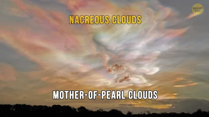
Next, we have polar stratospheric clouds, also known as Nacreous clouds or Mother-of-Pearl Clouds. I liked the third name the most. They are mostly seen in the Antarctica and Arctic region, but they can be spotted in places like Scotland, Scandinavia, and Alaska too. This type of clouds looks like an impressionist painter touched the sky with a brush. They appear as iridescent pastel shades in the sky around sunset time.
Nacreous clouds can be best seen during Civil Twilight. Meaning when the Sun is between 1–6 degrees under the horizon. They mostly form during winter at around 49,000 to 82,000 feet high. Mother-of-Pearl Clouds can be harmful to the atmosphere. Their existence may lead to a chemical reaction that breaks down the ozone layer.
Nature’s other incredible wonder is Morning Glory Cloud. It looks like a giant rice roll flying in the sky. This rare phenomenon can be regularly seen only in one place in the world; The southern part of the Gulf of Carpentaria in Australia. Although Morning Glory can be observed in other parts of the world, you have higher chances to see the Morning Glory Cloud around September and October.
This cloud bank says hello to Australians from often only around 330 to 660 feet above the ground. It can be 620 miles long and can travel at speeds of up to 38 miles per hour. If I were there, I’d record a timelapse of this cloud.
What’s cool is to see one of these fluffy clouds; what’s even better is to see up to 10 consecutive roll clouds. That happened before and can happen in the future too. Arcus cloud — it’s another name for it — has been known since ancient times. Not just modern day people noticed this unusual cloud formation.
The local Garrwa Aboriginal people gave it a special name. The Royal Australian Air Force pilots, too, reported seeing the arcus cloud in 1942. Then various teams of scientists studied this phenomenon. Okay, but how is this formed? With the right atmospheric conditions. When the humidity in the area is high, it provides moisture; if we add strong sea breezes to the equation, we can get the morning glory clouds.
Well, well... What do we have here? Pyrocumulus cloud. They may form as a result of convection started by heat from wildfires or volcanic activity. It’s generated as a result of the intense heating of air near the surface, which causes convection and lifts the air mass to a stable point. Moisture present in the atmosphere and evaporated from vegetation or volcanic gases can condense on ash particles, leading to the formation of this cloud. Since it’s generated by flames, it’s also called flammagenitus.
The next phenomenon is cloudbursts. You can think of these as giant balloons filled with water. When the balloon bursts, the water splashes. Similarly, here cloudbursts make rapid precipitation. They depend on thunderstorms. A thunderstorm may come with strong uprushes of air. This blocks the condensing raindrops from falling to the ground. As a result, a huge amount of water may accumulate at upper levels.
When the upward levels get weaker, the accumulated waterfalls at one time. I wouldn’t want to be around when the water dropped down. It would be like taking the world’s shortest shower. Luckily, cloudbursts are most commonly seen in mountainous areas. Let me give you an example of how intense this one can get. A rainfall of 2.47 inches in 3 minutes was recorded in Porto Bello, Panama, in 1911. That’s a lot of water dumped in a place at once.
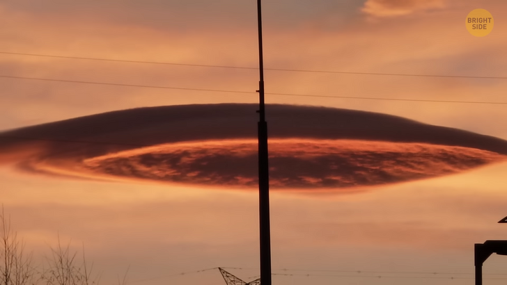
Now we have a solo riding cloud. It can occur in different parts of the world. Here we see a picture taken at Bursa, Türkiye. This orange-tinted, saucer-like cloud amazed and kinda scared people. We can relax. It was just a lenticular cloud. Think of this one as a pancake. Here clouds are placed in linearly stratified layers. Normally, those layers remain separated. But if an obstacle, in this case, Mount Uludag spans multiple layers, the air coming from beneath is forced to go up.
Why? Because air that’s closer to the ground holds more moisture. The moisture layer near the surface rises up with the air. The temperatures get cooler with height, and that air parcel is chilled down to its dew point as it ascends. Voilà!! The air becomes saturated and makes a cloud. This cloud doesn’t last very long. Once the accumulated air has passed over the mountain or the obstacle, it comes down to its regular level. Puff... it warms up again and disappears. Keep in mind that wind is an important element here. In our case, this cloud formed near mount Uludag because strong winds were coming from the south because of low pressure over northern Italy.
Rainbows are mesmerizing by themselves. What if I tell you that nature has gifted us also with a rainbow scarf cloud? World Meteorological Organization says that these kinds of clouds are called “pileus clouds,” but that’s a boring name. So I won’t use it. Rainbow scarf clouds are accessory clouds. This means they’re dependent on a larger cloud system to develop.
Firstly, an accessory cloud enlarges horizontally, and then a shape like a cap above the top occurs. This part is attached to the upper part of another cloud. These clouds don’t last long, similar to a regular rainbow’s time of appearance. The main cloud underneath eventually rises up and absorbs the rainbow cloud above. Farewell, you beautiful...
There are many other cloud formations that we can mention, such as Fallstreak Hole, or Hole Punch Clouds. Do you ever see that the horizon is full of white clouds, but there’s a hole to remind you of the blueness of the sky? It’s like someone put their hand into there and spread the clouds. The time is up! What are the other natural wonders that fascinate you?


