5 Simple Reasons You Might Feel Tired All the Time, and What You Can Do

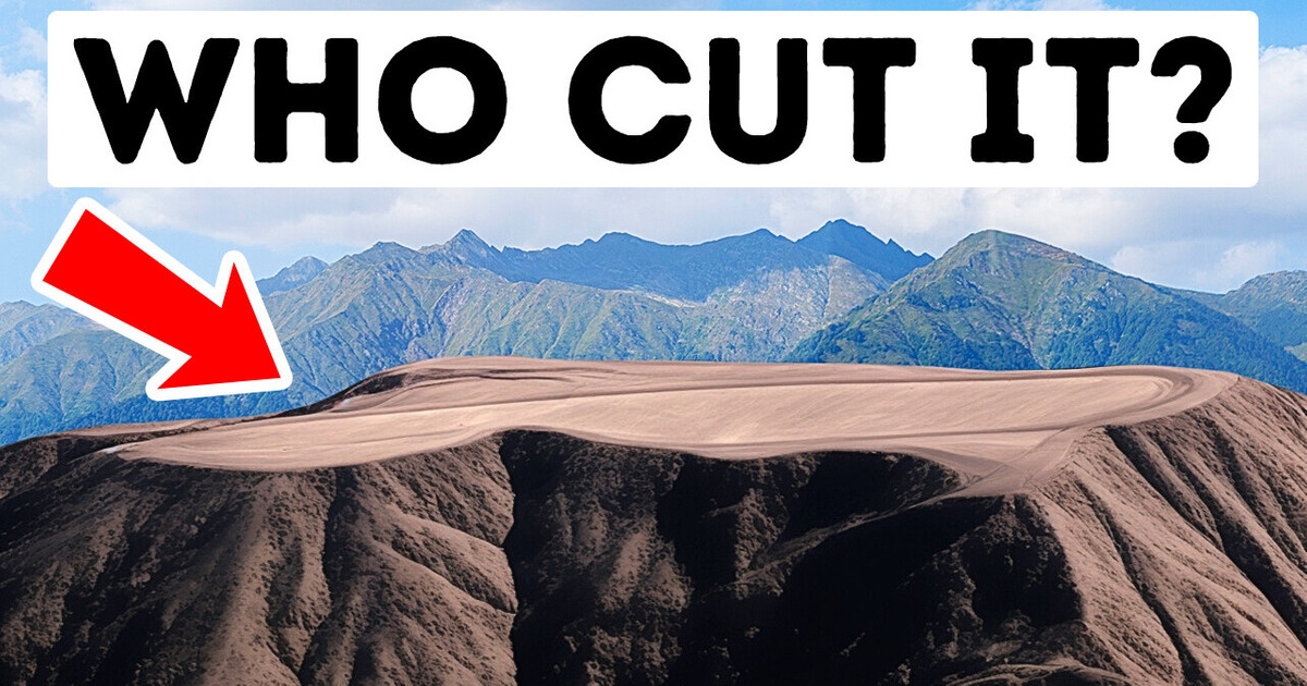
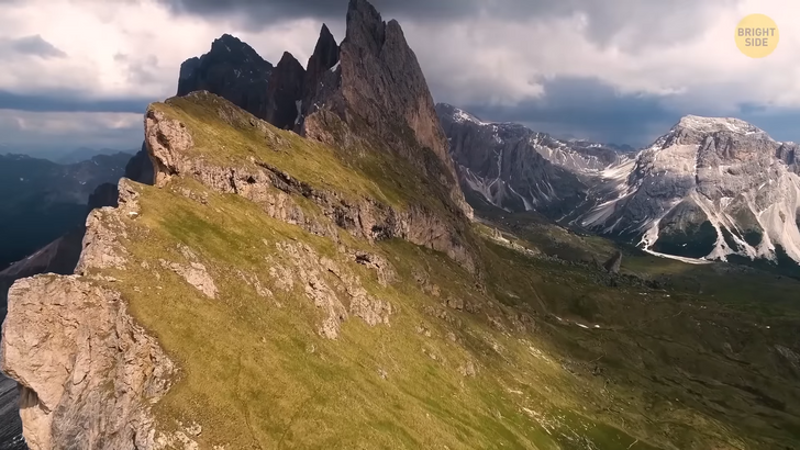
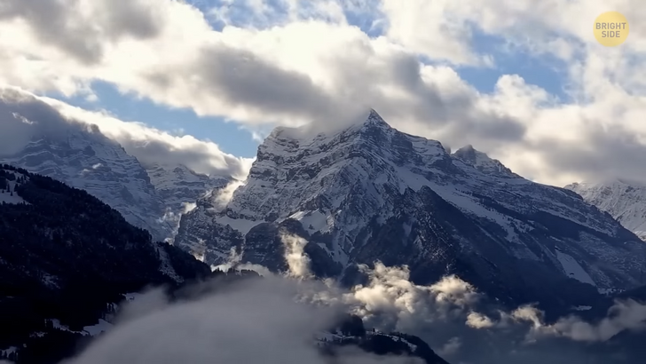
Mountains mean more to humanity than just lumps of rock. When the mountains are calling, I must go, says John Muir. So, let’s take a look at some of the most mysterious and interesting of them.
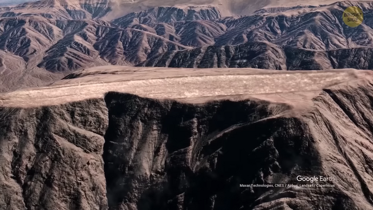
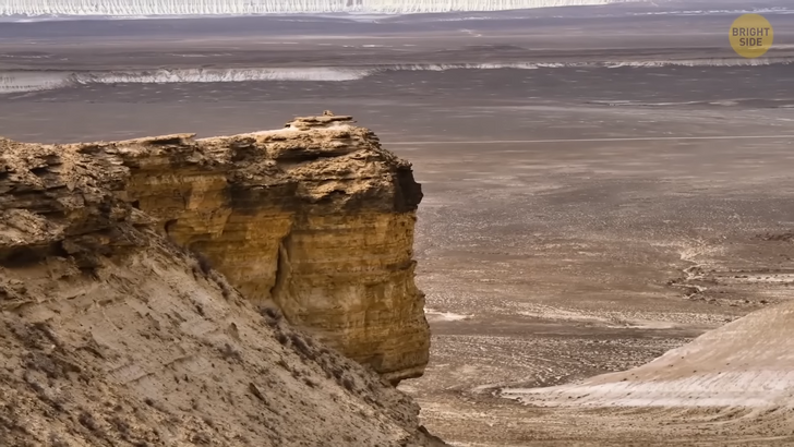
Meet the Nazca Runways. You know, when chefs use a spatula to flatten hard frosting on top of a cake? Yeah, it looks like someone did the same thing to this mountain. The flat mountaintop here definitely needs some explanation. Archeologists identified the Nasca and Palpa lines decades ago. You can find these lines in Peru. The geoglyphs cover around 174 square miles.
The Nasca and Palpa lines vary in terms of size, quantity, and nature. Some of the lines depict living creatures, plants, and some other imaginary beings and geometric shapes. The archeologists, at least, understand what they are. Yet, it remains a mystery how and why ancient people created massive flat runway-like marks thousands of years ago. They look as if something pressed down or cut the top of the mountain. There are a lot of rumors about them but no scientific explanations.
Now, let’s imagine a mountain that keeps growing every day. Well, there’s a real mountain like that in Canada. Mount Logan is the highest mountain in Canada and the second-highest peak in North America. If it grows like that, it can end up the tallest — someday. Who knows? Mount Logan is still rising in height by less than an inch per year. Such a huge number, I know. You can thank active tectonic uplift for this rise. But let’s leave Mount Logan’s ever-growing summit and move on to Australia.
Mount Conner, also known as Attila and Artilla, is another flat-topped mountain, but this one has a bonus. It’s horseshoe-shaped. The sides of Mount Conner are covered by scree, and its top is blanketed by colluvium — a loose mass of soil. As for the base of Mount Conner, it’s surrounded by alluvium — a deposit of clay, sand, and silt left by floodwaters. The mountain’s interesting shape results from erosion, which also caused Mount Conner to become an inselberg — an isolated mount rising sharply from a plain.
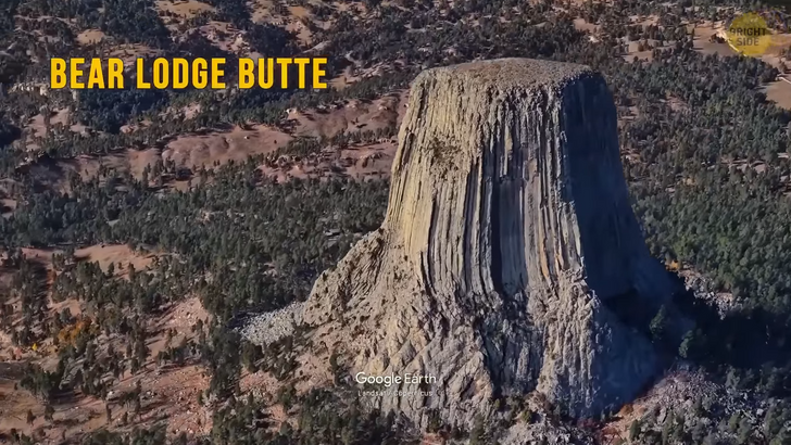
Number 4 is Devils Tower. This natural structure was the first United States national monument, established in 1906 by President Theodore Roosevelt. It’s also known as Bear Lodge Butte. The name itself has an interesting story. In 1875, during an expedition, an interpreter misunderstood the native name that meant “Bad Gods’ Tower.” The incorrect translation then stuck.
Now, all information signs in that area use the name “Devils Tower.” Over time, people asked the authorities to change the name so that it had its true meaning, but nothing was done. Geologists have been studying Devils Tower from the late 19th century to our day. They’ve had different theories, but one thing was clear. There was erosion at play. Rain and snow continue to erode the rocks surrounding the base. This process will go on, so there will be more of Devils Tower exposed.
It was also exposed as a movie star in the popular science fiction film “Close Encounters of the Third Kind”. It’s where the aliens landed. Oops, spoiler. Portions or even entire columns keep getting cut off and falling. Devil’s Tower is 1,267 feet tall, and it’s the world’s largest example of columnar jointing. Plus, the place is considered sacred to over 20 Native American tribes.
Makhtesh Ramon is a geological feature in the Negev desert. This place is the world’s largest “erosion cirque.” I know you might think that this landform resembles a volcanic crater or something like that because it looks like an elongated heart. Nope.
It’s hard to believe, but hundreds of millions of years ago, this desert was covered with an ocean. Then the water started to recede. A hump-shaped hill was left behind. Then, over time, the hill got flattened by water and climate forces. Rivers changed their directions. They carved the inner parts of the crater. Its bottom continued to become deeper.
This happened superfast compared to the pace of the formation of the surrounding walls. So, the walls gradually got higher, and the crater deepened. This led to more layers of ancient rock getting exposed. I mean, rocks at the bottom of the crater are up to 200 million years old. These days, the deepest point of the “crater” has the only natural water source in the area. It hosts wildlife, too.
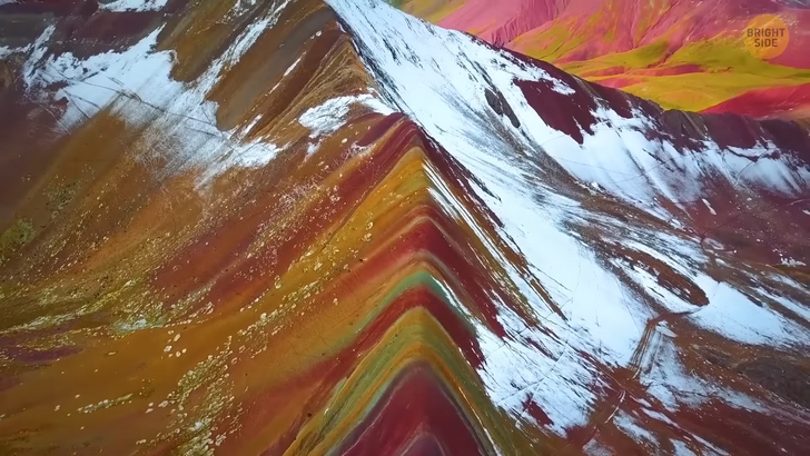
It looks like this image is photoshopped, I know, but it’s not. This geological wonder is located in China and is called the Rainbow Mountains. So, what causes the Rainbow Mountains to be colored the way they are? They formed from sandstones and siltstones. The sand and silt were deposited with iron and other minerals that turned out to be the key ingredients to creating the colors. Basically, there were 2 plates.
They started to collide and compress each other approximately 55 million years ago. Hey, I’m guessing. I wasn’t around then. In time, they folded and became this mountain. The sedimentary rocks would have stayed hidden — but the pressure pushed them to the surface. Again, the water and erosion removed some layers of rocks and exposed underlying formations that contained different minerals and elements. This is why you can now see mesmerizing colors all over the Rainbow Mountains.
Let’s move on to Mount Fuji in Japan. It looks funny with its graceful comical shape. Hold on, that should read conical shape. So it’s really not a funny mountain. My bad. It’s the highest mountain in Japan — 12,388 feet tall. Plus, it’s the most sacred one. Some Buddhists believe that this mountain is a portal to another world.
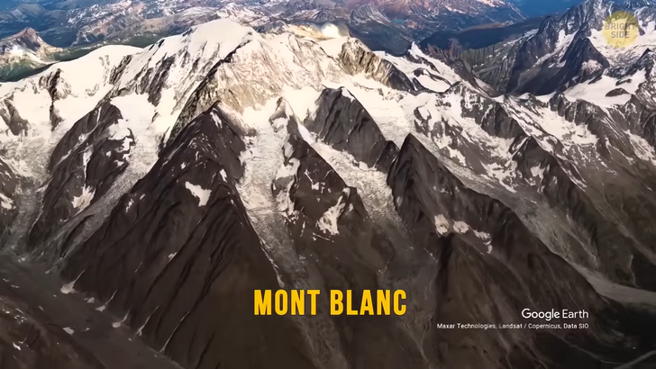
The next stop is the Massif of Mont Blanc. At 15,777 feet high, it’s the tallest mountain in the Alps. It’s also kinda infamous for its history of climbing accidents. Maybe it’s because this mountain is one of the most heavily trafficked mountains in the world.
About 20,000 people summit it every year despite the fact that the routes are full of hazards, such as falling rocks and avalanches. Rescue services say that during peak season, around 12 people go missing every weekend. The reason might be related to the long walks people go on. They don’t quite get how dangerous this can be.
Now, let’s talk about K2. Yes, that’s the name of a mountain. Interesting choice, huh? This mountain is on the border of China and Pakistan. It’s the second-highest mountain in the world, and this reputation attracts climbers from all over the world. The first woman to reach the summit was legendary climber Wanda Rutkiewicz. She reached the top in 1986. But over the next 18 years, all five female climbers who summited this peak were involved in unfortunate incidents.
Mount Kinabalu is in Malaysia. This mountain is home to many creatures, like orangutans. In fact, the mountain and its surroundings are among the most biologically diverse places on Earth. I’m talking about more than 5,000 species of plants, 326 species of birds, and more than 100 mammalian species. Ya know, mammals?
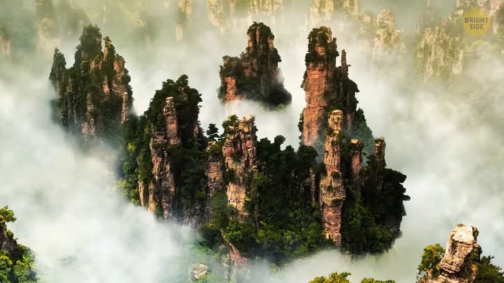
Zhangjiajie Pillars are in China. These structures are mostly made of quartz sandstone. They look so surreal, almost as if they’ve just popped out from a movie, right? Well, you’re not so wrong.
These natural structures became an inspiration for James Cameron when he was making one of his most famous movies, Avatar. Afterward, this mountain was renamed to Avatar Hallelujah Mountain. I guess there was a Cameron fan among the officials.
Okay, we know about Everest, the Alps, and other huge mountains. It made me wonder; what’s the smallest mountain in the world? It’s Mount Wycheproof, which rises only 141 feet above the surrounding terrain. It’s also a mere 486 feet above sea level. The mountain is in Australia.
There are debates about whether to categorize Mount Wycheproof as a hill or a mountain. Interestingly, more people have reached the summit of Mount Everest than that of Mount Wycheproof, though it is way easier to scale Wycheproof. Perhaps, they simply made a mountain out of a mole hill. You tell me.
This one is kind of a bonus because it’s not a mountain but a cluster of hills. I found it worth mentioning because it’s so cool! There are more than 1,250 chocolate hills in the Philippines’ Bohol Province.
What’s up with the name? They got it from the grass covering them. The green grass turns chocolate brown during the dry season. It sure looks delicious, but now I want to eat some chocolate.


