I am just install ing this app
10 Intriguing Places That Were Found Thanks to Google Maps
It’s such an intriguing idea to be able to travel around planet Earth without getting off the couch. Despite the fact that Google launched its Google Maps service back in 2005, curious users from different parts of the world still make interesting finds — from alien images to mysterious desert drawings and structures that have some historical value.
At Bright Side, we decided to explore the surface of our planet, and we discovered a few places that will stoke the imagination. At the end of the article, you will find a bonus that shows an object in the Bahamas that is so small it’s surprising satellites could even detect it.
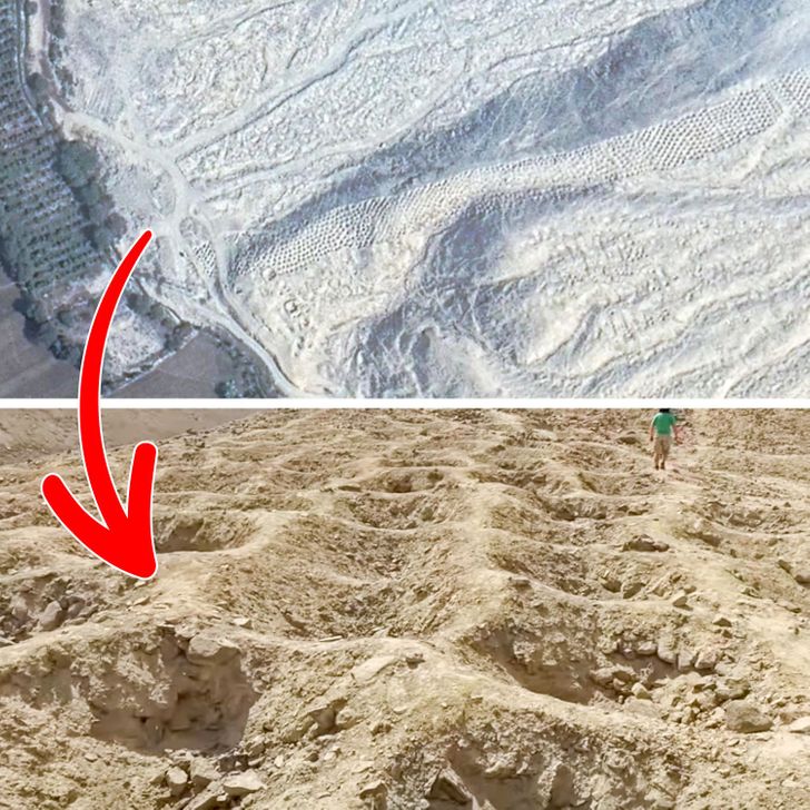
The Band of Holes, Peru
The Band is about 1 mile long and consists of about 6,000 strange holes of different diameters and depths. It originates in the Pisco Valley and stretches all the way to the Peruvian Andes. It looks impressive even from the height that the map allows, let alone live video footage from a drone.
The most interesting fact is that unlike the more renowned Nazca Lines (you can see these gigantic geometric figures on the map here), the purpose of this place and its creators has remained a mystery since 1933. At the moment, archaeologists can only make assumptions — for example, the holes could be either a burial site or they were used for storage, but all theories are subject to reasonable criticism, so there are more questions than answers.
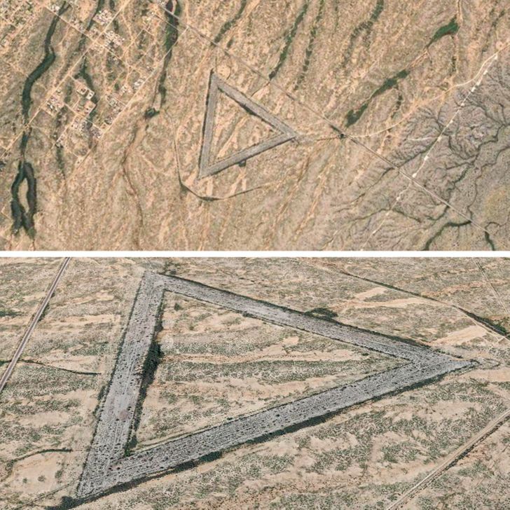
A giant triangle, USA
This mystic-looking place is located in Wittmann, Arizona. In reality, it’s an Air Force Base that was abandoned in approximately 1956-1966.
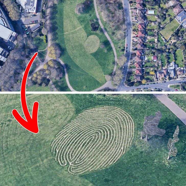
A fingerprint, the UK
This giant fingerprint, called the Fingermaze, is located in Hove Park in the English city of Brighton & Hove. This is a public sculpture that is carved into a park and lined with stone and lime mortar. The Fingermaze was created by the environmental artist Chris Drury in 2006, and it symbolizes the journey of life.
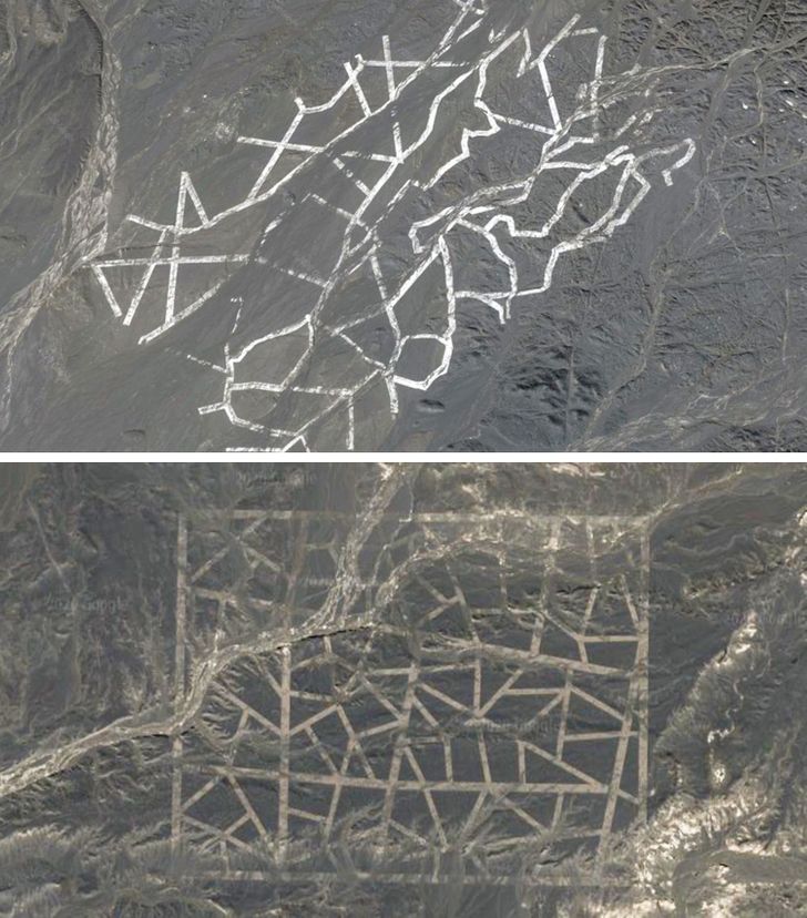
Mysterious symbols in a China desert
These symbols, which look like they were printed with a huge stamp on the Gobi Desert surface, have been assumed to be something alien for a very long period of time. However, they turned out to be a human creation. According to Jonathon Hill, a research technician and mission planner at the Mars Space Flight Facility at Arizona State University, these grids are most likely spy satellite calibration targets.
An alien face, Antarctica
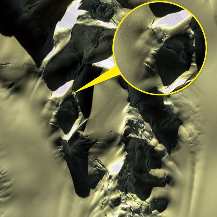
When this anomaly was found in the mountains of Antarctica, conspiracy theorists thought that this proved the existence of an alien civilization. However, there is a more logical theory. This is purely natural and random and looks like ice with cracks. Or it can be the result of pareidolia, a bizarre effect which causes the brain to see shapes, structures, and patterns where they don’t exist. According to NASA: “Pareidolia is the psychological phenomenon where people see recognizable shapes in clouds, rock formations, or otherwise unrelated objects or data.”
A memorial in the middle of a desert, Africa
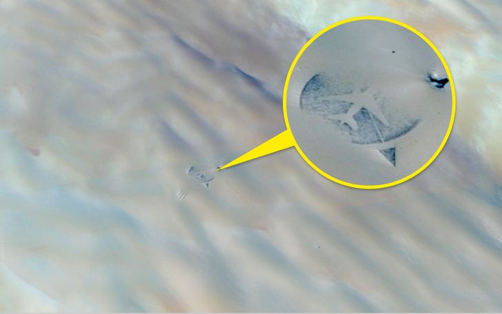
In 1989, a McDonnell Douglas DC-10-30 aircraft, was blown up over the Ténéré desert. 2007 was the 18th anniversary of the crash. It was the year when the memorial was constructed in the middle of the desert. A life-size silhouette of the aircraft lies inside a dark stone circle surrounded by 170 broken mirrors, each one representing someone who died.
Lonar Lake, India
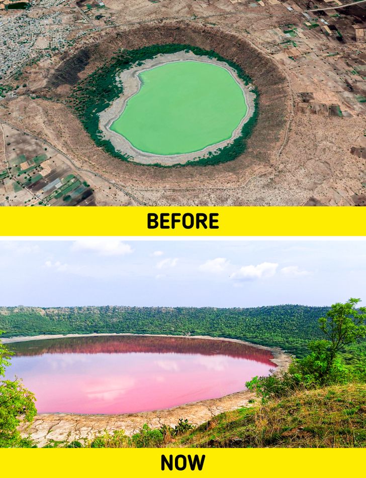
Lonar Lake was created by an asteroid collision with the earth about 50,000 years ago. The meteor crater rim is about 5,900 ft in diameter. Lonar Lake has a mean diameter of 3,900 ft and is about 449 ft below the crater rim.
In June 2020, something unexpected happened to the lake. The water changed its color to pink for 2-3 days. Experts believe that the change was likely due to either increased salinity in the water, the presence of algae, or a combination of both.
A huge target symbol, USA
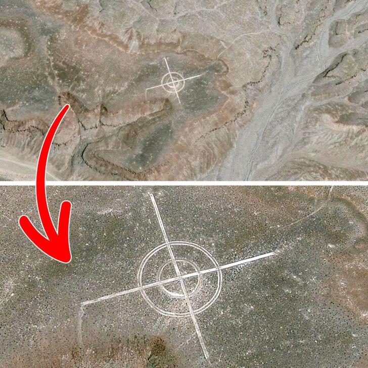
You might think that this is someone’s joke or an art object, but most likely this is a marking used as an aerial photo calibration target. Across the US there are said to be a number of similar markings and desert airbases.
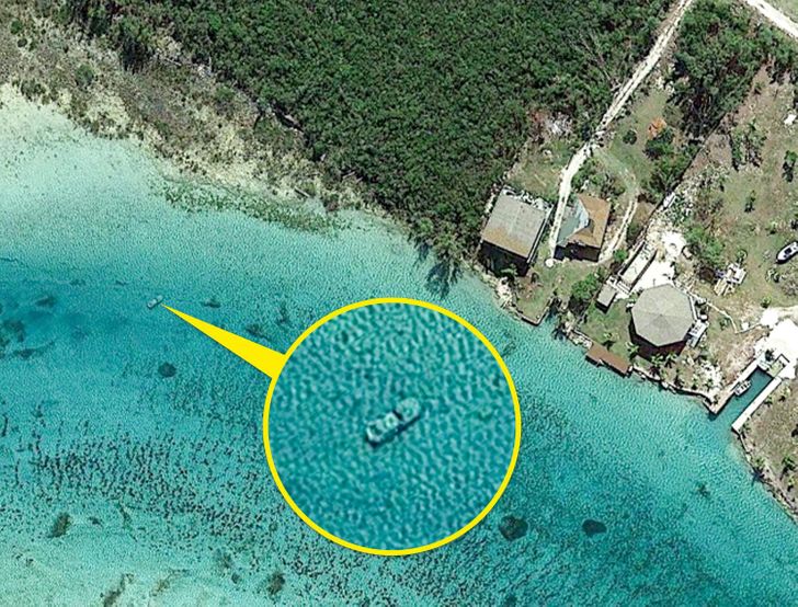
Bonus: An underwater car in the Bahamas
We don’t know the story of this object, but this image proves the wonderful precision of Google maps.
Have you ever explored Earth on Google maps? Did you make any discoveries? Share them in the comments below.
Comments
the Potash ponds look like someone spilled paint :D
I'd rather believe in aliens 😂
Related Reads
My Husband Cruelly Abandoned Me During Childbirth, and Here’s How I Got Even

I’m Being Thrown Out of My Own House by My DIL

10 Surprising Things You Can Get for Free When You’re Traveling

13 Real Stories That Could Be Turned Into Award-Winning Dramas

17 People Share Reasons Why They Decided to Get a Divorce

My DIL Severely Offended Me, She Regretted It When I Opened Up About Who I Really Am

My Fiancée Kicked Her Gay Teenage Daughter Out, I Made Her Taste Her Own Medicine

10 Wedding Disaster Stories That Were Signalling It Won’t Last for Long

10+ Stories With Endings More Disturbing Than a Halloween Film

My Stepdaughter Hates Me, but She’s About to Learn the Truth—It’s Time for a Reality Check

Mom Goes Viral as Her Behavior With Her Daughter, 7, Is Deemed Inappropriate

I Excluded My Stepson From Our Family Vacation

