Helen Hunt, 60, Stuns During Her Latest Appearance, and Her Lips Become the Center of Attention

Imagine you decided to take a road trip the old-fashioned way. And by that I mean you decided to do it without the help of any technology. (What?) So, you go to the nearest convenience store and buy a map of each state you plan to pass through. You buckle them up on the passenger’s seat right next to you and set off on your adventure!
During your first week, you arrive in the state of New York. You wave bye-bye to Lady Liberty, eat a slice of pizza and head upstate. Near Catskills, you notice you’re running low on gas and decide to stop in the nearest town to fill up your tank. You check your map, and it appears that the nearest place is a small village called Agloe, right at the next intersection.
You drive a few minutes and pass through a sign that says “Welcome to Agloe: Home to the Agloe General Store”. This must be it, you think to yourself. But the town is strangely empty. You can’t find the store or the gas station you were looking for. There are no houses. You start to think there might be a mistake. Agloe doesn’t seem to exist.
This story may sound made-up, but it could have happened to anyone passing through New York a few years ago. Actually, the so-called town of Agloe is what is called a phantom settlement, or a paper town. There are several of these around the world, but Agloe is perhaps the most famous. Paper towns are basically fake towns, i.e. they don’t really exist. They are made up of “Easter eggs” put there by mapmakers as a kind of copyright trap.
Maps are tough to make. To create a map from scratch, one has to do years of fieldwork or analysis of satellite photos. That’s why plagiarism has always been rampant among mapmakers. It’s pretty easy just to redraw the same geographical features from one map onto a new map, and it is hard to get caught.
People are, after all, drawing the exact same world. That’s why mapmakers came up with a way to catch individuals stealing their data. Some mapmakers may include a mountain that is bigger than they are in reality. Others might add a slight turn on a road where in reality there is none.
For example, in the early 1970s, a fake mountain peak appeared on some Boulder County maps. The addition of this previously unknown peak called Mount Richard into local maps began to confuse Colorado rock climbers at the time. It turned out that Mount Richard was one of these copyright traps, put there by a local maps man called Richard Ciacci.
Let’s just say he must have decided to pay a tribute to himself with this little addition. Now, adding a paper town is perhaps one of the most extreme solutions. One that mapmakers hope goes unnoticed. But that’s not what usually happens, which leads us back to the Agloe story.
Mapmakers Ernest Alpers and Otto Lindberg, from the CDG, General Drafting Corporation, were part of the largest map publishers of the 1930s. Back then, the company was commissioned to create a map of the state of New York. That’s when the two men had an idea.
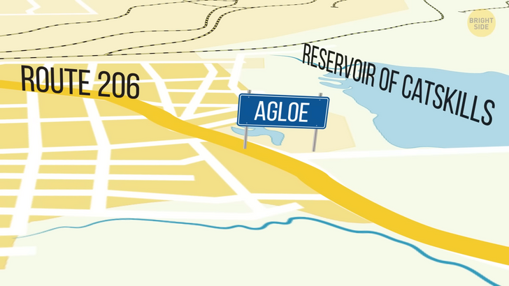
In order to prevent copyright infringement, they would create a phantom settlement combining parts of their names together. They came up with the strange name Agloe and added the fake town along Route 206, near the water reservoir of Catskills in upstate New York. The area was supposed to be, in reality, a dirt road.
Years later, Rand McNally, another map designing company, produced a map of New York that included a town called Agloe in the same location where CDG had originally placed it. Lindberg was convinced that he had a copyright case against his competitor, but the story just kept getting more complicated. Both companies went to settle the case in court. But, as it turned out, McNally had a legitimate reason for adding Agloe to their version of a New York map.
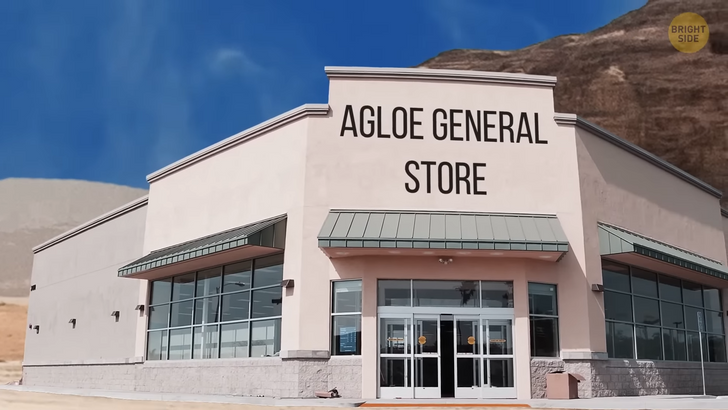
In order to fabricate their maps, McNally did a thorough research on real estate and establishments located in each existing town. And as it turned out, Agloe was not an empty town when they drew their map. Records showed that the town housed an establishment named Agloe General Store.
Sure, it was the only building in the town, but that was enough for the mapmakers to believe that such a town really existed. They added Agloe to the map like they would add any other town with physical establishments. It seemed they weren’t infringing any copyright if this once phantom settlement had somehow come to life.
The plot twist is that CDG’s Alpers and Lindberg could never have foreseen that someone would decide to occupy a made-up town. But it happened! One day, someone bought a map from a regional gas station that had Agloe marked on it.
The person wanted to open a store more or less where Agloe existed, so they decided to name the store after the town it was in. They trusted the accuracy of the map they bought and named their business ’Agloe General Store’. After all, why would there be a non-existent town on an official map?
The general store didn’t last many years — only enough to turn this story into a mess. On the bright side, this whole debacle turned Agloe into a super famous fictitious settlement. It became a tourist spot, with people driving from all over the US to get a picture of the town’s welcome sign.
Now, as we said before, paper towns are plenty around the world and over time too. A 2005 BBC documentary revealed that the City of London alone had over 100 tiny fake streets or paper streets around the city. For instance, the so-called Moat Lane is supposedly a curving road in Finchley, North London.
But if you ever decide to go visit, you’ll find nothing but trees and gardens. And what about Argleton, a town in the north of England? Or, more accurately, an empty field in northeastern England? Argleton existed for a while on Google Maps. There were hotel listings and apartments for rent in town. Well, the only thing is that they weren’t really in Argleton, but rather in nearby settlements.

It’s believed that Google Maps imported these fake streets into its database, as they used renowned copyrighted Atlases as their sources. But as the truth about these paper streets surfaced, the company later deleted them. If we turn back the clock a few hundred years, we’ll find another mystery story involving a possible phantom settlement. But this isn’t a tiny town at an intersection. But rather an entire island.
Bermeja island was speculated to be a tiny, inhabited island. It appeared on many maps of the 16th and 17th Centuries and was a hotspot for Spanish explorers. Its location sometimes varied slightly from map to map, and occasionally its name appeared as Vermeja, but its existence seemed certain enough. It wasn’t until the 18th century that the island stopped being depicted in maps altogether. This island’s last appearance dates back to a 1921 edition of a Mexican atlas and then, poof! It dropped out of the horizon altogether.
The case of Mexico’s disappeared island has raised many questions: did it sink? Was it destroyed? Are people simply looking for it in the wrong place? Three official investigations took place in 2009 to locate the island. They used high-end technologies, scouring Mexico’s oceans and seabeds. Yet, Bermeja remained nowhere to be found. One can’t help but wonder if the island ever existed at all.
Similar to modern-day mapmakers, 16th and 17th-century mapmakers had their way to trick map users. Instead of copyright traps, these fake towns or even fake islands served as a way to fool and confuse enemies and unwanted voyagers. Since a long time has gone by, it is hard to know whether Bermeja was just another phantom settlement. It stopped being depicted on maps, but this mysterious case still leaves people baffled and confused.


